Cottan-Bimbang National Park
Cottan-Bimbang is a perfect destination for car touring, turning the Oxley Highway into its own attraction, with additional driving routes and barbecues on offer too.
Read more about Cottan-Bimbang National Park
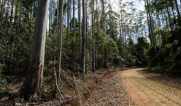
Cottan-Bimbang National Park is a driver’s dream – the best of nature experienced from the comfort of your own car. Rugged mountain vistas slide into view, then disappear as you wind your way along the highway south of Werrikimbe National Park. Formerly state forest, this area is now a candidate for inclusion in the Gondwana Rainforest World Heritage Area. In other words, there’s a great deal more here than just trees along the side of a road.
As you travel from Walcha or Wauchope, rainforest becomes dry eucalypt, tall and laden with birds. 'Cottan-bimbang' is the local Aboriginal word for the walking stick palm, which grows in the park's warm temperate rainforests. There’s even dry rainforest of myrtle tucked along the creek beds. During the day, this varied landscape is alive with birds and animals, like the brush turkey and shy parma wallaby.
But look a little closer and what you’ll find are fascinating traces of colonial heritage, too, with reminders of the gold mining era, convicts, and bushrangers. Bring a picnic and you’ll find quiet clearings by a river, and biking or hiking opportunities for the truly intrepid. When so much is passed by in daily life as you rush from one destination to the next, Cottan-Bimbang is the sort of place that makes you slow down and appreciate the world around you.
Local alerts
For the latest updates on fires, closures and other alerts in this area, see https://www.nationalparks.nsw.gov.au/visit-a-park/parks/cottanbimbang-national-park/local-alerts
Contact
- in the North Coast and Country NSW regions
Cottan-Bimbang National Park is always open but may have to close at times due to poor weather or fire danger.
-
-
Port Macquarie office
02 6588 5555 for general enquiries only, no bookings.
Contact hours: Monday to Friday, 9am to 4.30pm. - 22 Blackbutt Road, Port Macquarie NSW 2444
-
Email: npws.hastingsmacleay@environment.nsw.gov.au
-
Port Macquarie office
-
-
Walcha office
02 6777 4700
Contact hours: Monday to Friday, 8.30am to 4.30pm. - 188W North Street, Walcha NSW 2354
-
Email: npws.nea@environment.nsw.gov.au
-
Walcha office
Visitor info
All the practical information you need to know about Cottan-Bimbang National Park.
Map
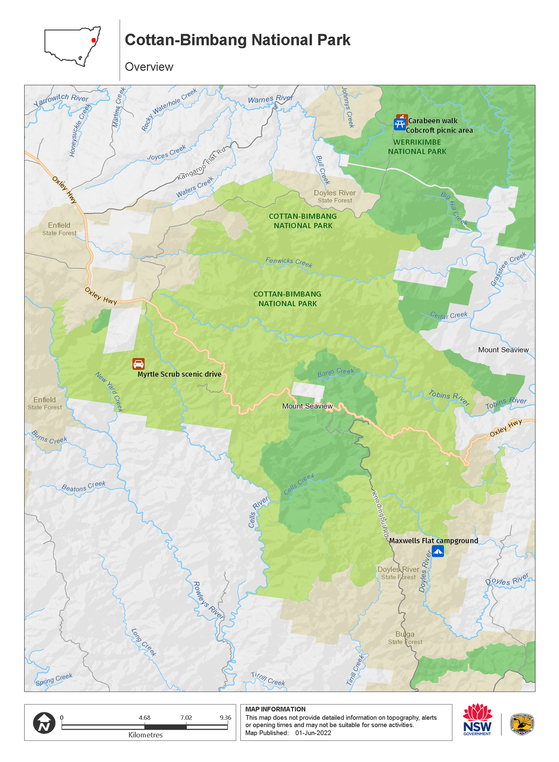
Map legend

Getting there and parking
Get driving directions
From either Walcha or Wauchope:
- Follow Oxley Highway , which leads directly through Cottan-Bimbang National Park.
By bike
Check out the Bicycle information for NSW website for more information.
Best times to visit
There are lots of great things waiting for you in Cottan-Bimbang National Park. Here are some of the highlights.
Autumn
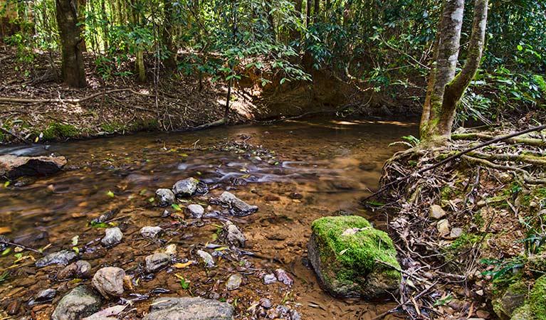
Settle down for a picnic at the clearing by Cells River and the magnificent timber bridge, a relic of former forestry management.
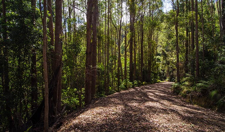
Spring
Take Myrtle Scrub scenic drive through old-growth wet eucalypt forest and rainforest, keeping an eye out for lyrebirds and bandicoots.
Weather, temperature and rainfall
Summer temperature
Average
17°C and 28.5°C
Highest recorded
42.2°C
Winter temperature
Average
6.1°C and 19.2°C
Lowest recorded
-5.1°C
Rainfall
Wettest month
January
Driest month
July
The area’s highest recorded rainfall in one day
236.6mm
Maps and downloads
Prohibited
Pets
Pets and domestic animals (other than certified assistance animals) are not permitted. Find out which regional parks allow dog walking and see the pets in parks policy for more information.
Smoking
NSW national parks are no smoking areas.
Nearby towns
Walcha (66 km)
Walcha is the gateway to some of the best adventure experiences in Australia. Expect gorges, rainforests, waterfalls and wilderness. Enjoy helicopter flights, 4WD tours and fishing, as well as guided bushwalks in some of Australia's most rugged terrain.
Wauchope (84 km)
Wauchope is great base for exploring nearby national parks that are part of the Gondwana Rainforests of Australia World Heritage Area. Follow the Hastings Forest Way to Werrikimbe National Park, a rugged wilderness of outstanding beauty spread with short and long walks. Willi Willi National Park is a rainforest mountain park with three beautiful walking tracks that follow the river and lead to a sparkling waterfall.
Taree (155 km)
Taree is a major mid North Coast city, ringed by superb beaches. It's situated on the Manning River and set against rolling hills.
Learn more
Cottan-Bimbang National Park is a special place. Here are just some of the reasons why:
Colonial settlers, gold, and bushrangers
Cottan-Bimbang has a rich past filled with colonial settlers and convicts. The famed explorer John Oxley first travelled through the area in 1818, on his way to the coast. In fact, the first convict road linking Port Macquarie to Walcha went through here; keep an eye out for stonework remnants buried in the undergrowth. Loggers came not long after in their search for cedar, the Red gold. Regular gold was sought here too Cells State Conservation Area, deep in the park, contains relics of early mining. And just to top off a dramatic, event-filled history, the bushranger Jimmy Governer (Jimmy Backsmith) travelled through the area with his brother before being captured closer to Port Macquarie.
- Myrtle Scrub scenic drive Myrtle Scrub scenic drive is a 14km alternative driving route to the highway straight through scenic views of Cottan-Bimbang National Park, tracing a trail past old-growth wet eucalypt forest and rainforest.
Aboriginal tracks
The name 'Cottan-Bimbang' is an Aboriginal word meaning 'walking stick palm', referring to a plant which can be found scattered throughout the national park. Echoes of Aboriginal occupation can also be seen in the routes used by early explorers and settlers, which were probably first used by Aboriginal people to travel between the coast and tablelands.
A potential World Heritage Area
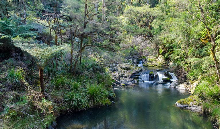
Rainforest makes up 40% of Cottan-Bimbang National Park, with subtropical rainforest in the centre around the catchment of Cells Creek, and warm temperate rainforest and dry rainforest of myrtle further out. Because of this diverse ecosystem, Cottan-Bimbang has been nominated for inclusion in the Gondwana Rainforest World Heritage Area.
The largest population of parma wallabies
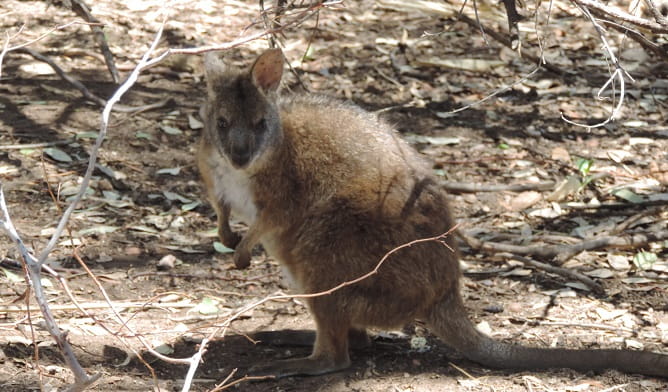
Explore Cottan-Bimbang National Park and you may be fortunate enough to spot the shy parma wallaby in the area. The largest population of parma wallabies reside within Cottan-Bimbang National Park. Approximately half the park is made up of native old-growth forest, making it ideal for a refreshing bushwalk, or just as a means to escape into nature.
- Myrtle Scrub scenic drive Myrtle Scrub scenic drive is a 14km alternative driving route to the highway straight through scenic views of Cottan-Bimbang National Park, tracing a trail past old-growth wet eucalypt forest and rainforest.
Education resources (1)
What we're doing
Cottan-Bimbang National Park has management strategies in place to protect and conserve the values of this park. Visit the OEH website for detailed park and fire management documents.
General enquiries
- National Parks Contact Centre
- 7am to 7pm daily
- 1300 072 757 (13000 PARKS) for the cost of a local call within Australia excluding mobiles
- parks.info@environment.nsw.gov.au
Contact
- in the North Coast and Country NSW regions
Cottan-Bimbang National Park is always open but may have to close at times due to poor weather or fire danger.
-
-
Port Macquarie office
02 6588 5555 for general enquiries only, no bookings.
Contact hours: Monday to Friday, 9am to 4.30pm. - 22 Blackbutt Road, Port Macquarie NSW 2444
-
Email: npws.hastingsmacleay@environment.nsw.gov.au
-
Port Macquarie office
-
-
Walcha office
02 6777 4700
Contact hours: Monday to Friday, 8.30am to 4.30pm. - 188W North Street, Walcha NSW 2354
-
Email: npws.nea@environment.nsw.gov.au
-
Walcha office