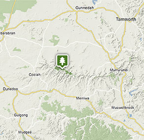
Coolah Tops National Park
Visitor info
All the practical information you need to know about Coolah Tops National Park.
Getting there and parking
Get driving directions
From Coolah:
- Head east on the sealed Coolah Creek Road for approximately 19km
- Turn right onto unsealed The Tops Road
- Continue along this unsealed road with some steep climbs for another 11km before entering the park
Park entry points
- Coolah Tops Forest Road access See on map
Parking
- Bundella lookout See on map
- Grass Tree walking track See on map
- Snow Gum walking track See on map
By bike
Check out the Bicycle information for NSW website for more information.
By public transport
For information about public transport options, visit the NSW country transport info website
Best times to visit
There are lots of great things waiting for you in Coolah Tops National Park. Here are some of the highlights.
Autumn
Great camping weather before the cold weather arrives. Swap stories by the campfire about the day's adventures.
Spring
See the park come to life as the pink darling pea, yellow flowering black wattle and silver wattle burst into colour.
Summer
Enjoy warm days walking and mountain biking and cooler nights in the bush.
Weather, temperature and rainfall
Summer temperature
Average
15°C and 30°C
Highest recorded
40.3°C
Winter temperature
Average
2°C and 15°C
Lowest recorded
-6.7°C
Rainfall
Wettest month
January
Driest month
May
The area’s highest recorded rainfall in one day
186.7mm
Facilities
Toilets
Picnic tables
Barbecue facilities
Drinking water
Maps and downloads
Prohibited
Pets
Pets and domestic animals (other than certified assistance animals) are not permitted. Find out which regional parks allow dog walking and see the pets in parks policy for more information.
Smoking
NSW national parks are no smoking areas.
Contact
- in the Country NSW region
Coolah Tops National Park is always open but may have to close at times due to poor weather, fire danger or management operations. The eastern end of the park is regularly closed during wet weather due to slippery road conditions.
-
-
Warrumbungle NP Visitor Information Centre
02 6825 4364
Contact hours: 9am to 4pm daily. Closed Christmas Day. - 4261 John Renshaw Parkway, Warrumbungle NSW 2828
-
Email: warrumbungle.np@environment.nsw.gov.au
-
Warrumbungle NP Visitor Information Centre
Nearby towns
Coolah (31 km)
Coolah is the gateway to Coolah Tops National Park, a subalpine park with tall eucalypt forests, waterfalls, giant grass trees and scenic forest drives. See animals in the wild, including the greater glider - the largest of Australia's gliding possums.
Coonabarabran (112 km)
Coonabarabran is the closest town to the craggy peaks and spires of the Warrumbungle Ranges. Warrumbungle National Park is popular for bushwalking, camping and encountering wildlife amid breathtaking scenery.
Merriwa (114 km)
Merriwa is a unique and friendly rural town nestled in the Upper Hunter Valley. Situated on the Golden Highway, Merriwa is the ideal place for a stopover, as it is centrally located. In just two hours you can reach Mudgee, Dubbo, Newcastle and Tamworth.