Conjola National Park
Visitor info
All the practical information you need to know about Conjola National Park.
Getting there and parking
Get driving directions
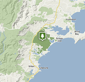
Conjola National Park is accessible via a number of points along the Princes Highway – look for the signposts to particular areas.
- From Sussex Inlet, take The Springs Road to Goonawarra Drive and other park roads.
- From Ulladulla or Bendalong, turn north from Bendalong Road onto Cedar Road to reach the Monument Beach picnic area.
Park entry points
- Goonawarra Drive access See on map
- Holly Street, Bendalong See on map
- The Springs Road access See on map
Parking
- Monument Beach picnic area See on map
Road quality
- Unsealed roads
Vehicle access
- 2WD vehicles
Weather restrictions
- Dry weather only
By bike
Check out the Bicycle information for NSW website for more information.
By public transport
For information about public transport options, visit the NSW country transport info website.
Best times to visit
There are lots of great things waiting for you in Conjola National Park. Here are some of the highlights.
Autumn
As the temperature cools slightly, this a great time to get active in the park with some bushwalking and mountain biking.
Spring
The wildflowers – waratahs and wattle among them – are in full bloom, bringing with them large numbers of birds. You might even be lucky enough to spot the rare Scalet Honeyeater or Little Lorikeet.
Summer
Hot weather means plenty of time for the beach and water. Keep an eye open for the endangered hooded plover and other shorebirds foraging on the sand.
Winter
The light is clear and beautiful and the beaches and trails very quiet – just the thing if you prefer exploring with few other people around.
Weather, temperature and rainfall
Summer temperature
Average
19°C and 24°C
Highest recorded
40.6°C
Winter temperature
Average
10°C and 18°C
Lowest recorded
-3.2°C
Rainfall
Wettest month
May
Driest month
September
The area’s highest recorded rainfall in one day
316.7mm
Facilities
Toilets
Picnic tables
Drinking water
Maps and downloads
Prohibited
Pets
Pets and domestic animals (other than certified assistance animals) are not permitted. Find out which regional parks allow dog walking and see the pets in parks policy for more information.
Smoking
NSW national parks are no smoking areas.
Contact
- in the South Coast region
Conjola National Park is always open but may have to close at times due to poor weather or fire danger.
-
-
Ulladulla office
02 4454 9500
Contact hours: Monday to Friday, 9am to 4pm. - Lot 9 Blackburn Industrial Estate, 6 Coller Road Ulladulla NSW 2539
-
Email: npws.shoalhaven@environment.nsw.gov.au
-
Ulladulla office
-
-
Nowra office
02 4428 6300
Contact hours: Monday to Friday, 9am to 4pm. - 104 Flatrock Road, Mundamia NSW 2540
-
Email: npws.shoalhaven@environment.nsw.gov.au
-
Nowra office
Nearby towns
Lake Conjola (29 km)
Lake Conjola is a deep coastal lake regularly open to the sea which provides a wonderful playground for fishing and boating enthusiasts.
Ulladulla (35 km)
Ulladulla is close to several wonderful national parks. Morton National Park, to the west, is home to Pigeon House Mountain, a local landmark which is a popular climb. Murramarang National Park, between Ulladulla and Batemans Bay, has beautiful coastal walks, beaches and camping sites.
Nowra (45 km)
Nowra is a historic city and the commercial heart of the Shoalhaven. It's on the Shoalhaven River close to beaches and national parks.