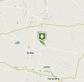
Cocoparra National Park
Visitor info
All the practical information you need to know about Cocoparra National Park.
Getting there and parking
Get driving directions
From Griffith:
- Travelling east along Burley Griffin Way from town centre, turn left onto Crossing Street.
- Turn right onto Wakaden Street. This becomes Rankin Springs Road, and then Beelbangera Road as you pass through Beelbangera.
- At Yenda, turn left onto Myall Park Road.
- Turn right onto Mount Bingar Road, which will take you into the park.
- Road signs provide directions along the route from Griffith to Cocoparra National Park
Please note that the eastern side of Cocoparra National Park connects to private property. There is no access to the park from Pleasant Valley Road and you will not be able to enter the park from the Eastern Boundary fire trail as this is for park management only.
If you're visiting the park, please enter from the western side, via Barrys Scenic Drive or Mount Bingar Road.
Park entry points
- Barry Scenic Drive See on map
- Mount Bingar Road access See on map
- Mount Brogden carpark See on map
- Woolshed Falls access See on map
Parking
- Spring Hill picnic area See on map
- Store Creek picnic area See on map
- The Pines picnic area See on map
By bike
Check out the Bicycle information for NSW website for more information.
By public transport
For information about public transport options, visit the NSW country transport info website.
Best times to visit
There are lots of great things waiting for you in Cocoparra National Park. Here are some of the highlights.
Autumn
Camp at Woolshed Flat while the days are still long and warm enough to explore the walking tracks and the cool nights are pleasant for sitting and watching the sun set Keep an eye out for the autumn greenhood, an early flowering orchid. .
Spring
Take Jacks Creek walking track to see gorgeous spring flowers, including orchids, daisies, wattles and tea-trees. Watch the first rainbow bee-eaters arrive to build nests in the ground. Their brilliant colours are dazzling. Climb Mount Brodgen to look out over the plains and the tree line of Murrumbidgee River .
Winter
Winter rains bring the creeks and falls to life, and the blue-tinged cypress pine trees contrast against the red rocks beautifully after wet weather. The mosses and lichens on Falcon Falls walking track are also renewed with the seasonal rains Wattles begin to flower and their glorious colour will brighten up a cold day .
Weather, temperature and rainfall
Summer temperature
Average
15°C and 33°C
Highest recorded
44.7°C
Winter temperature
Average
3°C and 17°C
Lowest recorded
–4.8°C
Rainfall
Wettest month
October
Driest month
December
The area’s highest recorded rainfall in one day
111.3mm
Facilities
Amenities
Toilets
Picnic tables
Barbecue facilities
Maps and downloads
Prohibited
Pets
Pets and domestic animals (other than certified assistance animals) are not permitted. Find out which regional parks allow dog walking and see the pets in parks policy for more information.
Smoking
NSW national parks are no smoking areas.
Contact
- in the Murray-Riverina region
Cocoparra National Park is always open but may have to close at times due to poor weather or fire danger.
-
-
Griffith office
02 6966 8100
Contact hours: Monday to Friday, 9am to 4pm. Closed 1pm to 2pm. - 200 Yambil Street, Griffith NSW 2680
-
Email: npws.riverina@environment.nsw.gov.au
-
Griffith office
Nearby towns
Griffith (27 km)
Griffith is at the heart of the vast Murrumbidgee Irrigation Area and produces about 60% of the grapes grown in the State. Today, there are more than a dozen wineries in the district with world-famous names. Visit De Bortoli or Hanwood and stock up on local produce, such as jams, preserves or pasta sauces.
Leeton (58 km)
Become a twitcher for a day and spot migratory birds, rare species and waterfowl that travel en masse to Fivebough Wetlands. More than 170 species migrate here throughout the year so it's no surprise that the annual Australian Bird Fair is a major drawcard.
Narrandera (87 km)
Narrandera is a Country NSW National Trust Urban Conservation Area located at the crossroads of the Newell and Sturt highways. This tranquil rural town in the heart of Riverina features tree-lined streets, fine historic buildings and many historic attractions.