Warrabah National Park
Visitor info
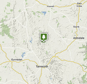
All the practical information you need to know about Warrabah National Park.
Getting there and parking
To get to Warrabah or Gum Hole campgrounds and picnic areas, you’ll need to drive via Manilla.
Don’t use Google Maps to direct you to these campgrounds. It will take you on unsafe, ummarked roads through private property. You can use Google Maps to get you to Manilla only. From Manilla, please follow these directions:
- Travel north out of town across the Namoi River towards Barraba
- About 500m north of the bridge turn right onto Barraba Street
- Continue onto Namoi River Road and follow the signs to Warrabah National Park
To get to Muluerindie, you’ll need to have a booking.
Muluerindie is located 60km (1hour) west of Uralla, via Retreat Road. Detailed directions will be provided in your booking confirmation, but you can approach from:
- Uralla on the New England Highway
- Manilla (in the west) via Halls Creek Road then onto Stone Hut Road
- Inverell (in the north) through Kingstown via Kingstown Road
- Bendemeer (in the south) via Retreat Road
Parking
- Gum Hole campground and picnic area See on map
- Warrabah campground and picnic area See on map
By bike
Check out the Bicycle information for NSW website for more information.
By public transport
For information about public transport options, visit the NSW country transport info website
Best times to visit
There are lots of great things waiting for you in Warrabah National Park. Here are some of the highlights.
Autumn
Make the most of the cooler days to explore some of the park's more heart-pumping bushwalks.
Spring
A lovely time to enjoy picnicking by the river, indulging in wildlife and nature photography, birdwatching, and bushwalking.
Summer
Cool off from the heat in the lovely Namoi River with a swim and a splash, enjoy a spot of fishing, or take on a bracing canoeing adventure.
Winter
The park is often quiet at this time of year, yet doesn't get too cold, so it's a good opportunity to go bushwalking and birdwatching in solitude.
Weather, temperature and rainfall
Summer temperature
Average
17°C and 32°C
Highest recorded
41.3°C
Winter temperature
Average
0°C and 18°C
Lowest recorded
-9.4°C
Rainfall
Wettest month
January
Driest month
April
The area’s highest recorded rainfall in one day
194.3mm
Facilities
Toilets
Picnic tables
Barbecue facilities
Drinking water
Showers
Maps and downloads
Prohibited
Pets
Pets and domestic animals (other than certified assistance animals) are not permitted. Find out which regional parks allow dog walking and see the pets in parks policy for more information.
Smoking
NSW national parks are no smoking areas.
Contact
- in the Country NSW region
Warrabah National Park is always open but may have to close at times due to fire danger or flooding.
-
-
Armidale office
02 6738 9100
Contact hours: Monday to Friday, 8.30am to 5pm. - 145 Miller Street, Armidale NSW 2350
-
Email: npws.nea@environment.nsw.gov.au
-
Armidale office
-
-
Narrabri office
02 6792 7300
Contact hours: Monday to Friday, 8.30am to 4.30pm. - Level 1, 100 Maitland Street, Narrabri NSW 2390. Accessible via Dewhurst Street.
-
Email: npws.barwon@environment.nsw.gov.au
-
Narrabri office
Nearby towns
Barraba (80 km)
Barraba is a birdwatcher's paradise - spot the rare Regent Honeyeater on one of the region's 14 bird routes, which have fine tree cover and good public access. There are plenty of great spots for bushwalking, such as through remnant rainforest in Mount Kaputar National Park.
Tamworth (83 km)
Tamworth's annual Country Music Festival is the largest music festival in the southern hemisphere and one of the top 10 music festivals in the world, with more than 2,200 events and 400 performances or gigs across 90 venues.
Armidale (179 km)
During autumn the parks and gardens around Armidale show their beautiful colours. Enjoy a drive along the Waterfall Way, stopping at waterfalls and craggy gorges in the rugged countryside.