Copeland Tops State Conservation Area
Visitor info
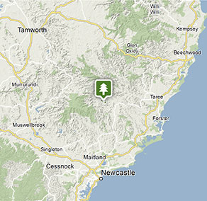
All the practical information you need to know about Copeland Tops State Conservation Area.
Getting there and parking
Get driving directions
From Gloucester:
- Follow Thunderbolts Way northwest out through the village of Barrington and over the single-lane bridge
- Continue west on Barrington Tops Forest Road until you come to Copeland village
- Turn left into Copeland Road and follow this road to the carpark at the end
Park entry points
- Copeland Road access See on map
- Copeland Tops access See on map
- Sleepy Hollow Trail access See on map
Parking
- Hidden Treasure picnic area See on map
- Mountain Maid gold mine See on map
By bike
Check out the Bicycle information for NSW website for more information.
By public transport
For information about public transport options, visit the NSW country transport info website.
Best times to visit
There are lots of great things waiting for you in Copeland Tops State Conservation Area.
Spring
This season offers mild walking conditions as well as the chance to witness bird migration. For instance, the wompoo fruit-dove – Australia's largest fruit dove – migrates from lower elevations in winter to upland forests in the warmer months.
Summer
There's nothing like rainforest to keep you cool; it's always several degrees less beneath the protective canopy, so enjoy following the park's walking tracks and finding shady places to picnic during the hotter months. The park's raised elevation also contributes to these milder conditions.
Weather, temperature and rainfall
Summer temperature
Average
17°C and 26°C
Highest recorded
28°C
Winter temperature
Average
6.7°C and 14.5°C
Lowest recorded
7°C
Rainfall
Wettest month
February
Driest month
July
The area’s highest recorded rainfall in one day
261.6mm
Facilities
Toilets
Picnic tables
Barbecue facilities
Maps and downloads
Prohibited
Pets
Pets and domestic animals (other than certified assistance animals) are not permitted. Find out which regional parks allow dog walking and see the pets in parks policy for more information.
Smoking
NSW national parks are no smoking areas.
Contact
- in the North Coast region
Copeland Tops State Conservation Area is always open but may have to close at times due to poor weather or fire danger.
-
-
Gloucester office
02 6538 5300
Contact hours: Monday to Friday, 8.30am to 4.30pm. - 59 Church Street, Gloucester NSW 2422
-
Email: npws.barringtontops@environment.nsw.gov.au
-
Gloucester office
Nearby towns
Gloucester (18 km)
Famous for gold deposits and the bushranger Captain Thunderbolt, Gloucester is located in the north Hunter region, east of Barrington Tops. The nearby state forests and national parks are ideal for walking, camping and outdoor adventure sports.
Dungog (80 km)
Dungog is a country town with character, backed by magnificent rolling hills, national parks and state forests. It's in the heart of dairy and beef cattle country.
Taree (93 km)
Taree is a major mid North Coast city, ringed by superb beaches. It's situated on the Manning River and set against rolling hills.