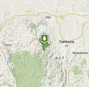
Brindabella National Park
Visitor info
All the practical information you need to know about Brindabella National Park.
Getting there and parking
Get driving directions
From Canberra:
- Travel west along Uriarra Road to Brindabella Road
- The dirt road starts along Brindabella Road, which takes you to the southern edge of Brindabella National Park.
There is no public access to the eastern side of the park from Mountain Creek Road. Doctors Flat Road is a private road, and is locked between Mountain Creek Road and Maginot trail.
Park entry points
- Blue Range Trail access See on map
- Doctors Flat Road access See on map
- Gentle Annie Trail access See on map
- Two Sticks Road access See on map
Road quality
Access to McIntyres Hut, Lowell's Flat and Flea Creek campgrounds not recommended for camper trailers as the trails are very steep.
- Unsealed roads
Vehicle access
- All roads require 4WD vehicle
Weather restrictions
- Dry weather only
By bike
Check out the Bicycle information for NSW website for more information.
By public transport
Brindabella National Park is not accessible by public transport.
Best times to visit
There are lots of great things waiting for you in Brindabella National Park. Here are some of the highlights.
Spring
Enjoy the milder weather and take in the spectacular views and spring wildflowers as you explore the park on one of the many 4WD trails.
Summer
Perfect for a camping weekend on the banks of the Goodradigbee River. Relax under the shade of a river she-oak and see if you can spot a wallaby or kangaroo feeding on the river flats.
Weather, temperature and rainfall
Summer temperature
Average
11°C and 29°C
Highest recorded
42.5°C
Winter temperature
Average
0°C and 12°C
Lowest recorded
-10°C
Rainfall
Wettest month
August
Driest month
April
The area’s highest recorded rainfall in one day
200mm
Facilities
Maps and downloads
Prohibited
Pets
Pets and domestic animals (other than certified assistance animals) are not permitted. Find out which regional parks allow dog walking and see the pets in parks policy for more information.
Smoking
NSW national parks are no smoking areas.
Contact
- in the Country NSW and Snowy Mountains regions
Brindabella National Park is always open but may have to close at times due to poor weather or fire danger.
-
-
Queanbeyan office
02 6229 7166
Contact hours: Monday to Friday, 8.30am to 4.30pm. - Level 3, 11 Farrer Street, Queanbeyan NSW 2620
-
Email: npws.alpinequeanbeyan@environment.nsw.gov.au
-
Queanbeyan office
-
-
Tumut Region Visitor Centre
02 6947 7025
Contact hours: 9am to 5pm daily. Closed Christmas Day. - The Old Butter Factory, 5 Adelong Road, Tumut NSW 2720
-
Email: tumutrvc@environment.nsw.gov.au
-
Tumut Region Visitor Centre
Nearby towns
Canberra (53 km)
Canberra is the home of Australia's Parliament House, National Gallery, National Museum and War Memorial, as well as many more significant cultural and architectural offerings. Kids of all ages love the interactive science and technology at Questacon.
Yass (57 km)
This historic country town is the home of explorer Hamilton Hume. Discover heritage treasures along the town's Historic Walk and Drive; you can even follow in the footsteps of explorers on the Hume and Hovell Walking Track.
Murrumbateman (74 km)
Follow the Poacher's Way, a self-drive route that passes through rural townships and tranquil grazing land. Stop along the way to enjoy the region's best cafes, wineries, art galleries and welcoming B&Bs.