Yuelarbah walking track
Glenrock State Conservation Area
Visitor info
All the practical information you need to know about Yuelarbah walking track.
Track grading
Features of this track
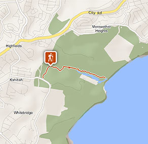
Distance
6.8km return
Time
2 - 3hrs
Quality of markings
Sign posted
Experience required
No experience required
Gradient
Short steep hills
Steps
Many steps
Quality of path
Formed track, some obstacles
Accessible options
The first 600m of this track to where it crosses Flaggy Creek is a mix of sealed bitumen, timber boardwalk, and compacted gravel pathway. It's suitable for wheelchairs, prams and visitors with limited mobility.
Getting there and parking
Get driving directions
Yuelarbah walking track is located at the eastern end of Glenrock State Conservation Area. To get there:
- From Newcastle, Charlestown and Sydney, exit the pacific Highway at Dudley Road or Kahibah Road, then turn into Burwood Road.
Parking
There's parking in bitumen seal Yuelarbah carpark on Burwood Road, including 3 accessible parking spaces.
Parking is also available in bitumen seal Angophora carpark.
Best times to visit
There are lots of great things waiting for you in Glenrock State Conservation Area. Here are some of the highlights.
Autumn
Enjoy exploring the park's mountain biking trails when the weather becomes cooler.
Spring
The park's birds will be chirping and singing, look out for them in the trees as you hit the tracks and trails.
Summer
The park's beaches are a delight at this time of year – you can surf and swim to your heart's content.
Winter
Walk the Bombala walking track for excellent coastal views – you may even spot a whale or two.
Weather, temperature and rainfall
Summer temperature
Average
20°C and 25°C
Highest recorded
42°C
Winter temperature
Average
11°C and 18°C
Lowest recorded
1.8°C
Rainfall
Wettest month
March
Driest month
November
The area’s highest recorded rainfall in one day
283.7mm
Facilities
Carpark
Maps and downloads
Accessibility
Disability access level - medium
- The first 600m of this track to Flaggy Creek is a mix of sealed bitumen, timber boardwalk, and compacted gravel pathway. It's suitable for wheelchairs, prams and visitors with limited mobility.
- There are several picnic tables at Flaggy Creek to rest at.
- Assistance may be required along gravel or sloping sections of the track.
- There are 3 accessible parking spaces in bitumen seal Yuelarbah carpark, on Burwood Road.
Medium access presents some minor difficulties, such as a grassy surface. You may require a little assistance to get around in some areas.
Prohibited
Mountain biking is not permitted on this track
Pets
Pets and domestic animals (other than certified assistance animals) are not permitted. Find out which regional parks allow dog walking and see the pets in parks policy for more information.
Smoking
NSW national parks are no smoking areas.
Operated by
- Newcastle office
- Monday to Friday, 8.30am to 4.30pm.
- 02 4946 4100
- npws.lowerhunter@environment.nsw.gov.au
- 1 Wetlands Place, Shortland NSW 2307
Park info
- in Glenrock State Conservation Area in the North Coast region
Glenrock State Conservation Area is always open but may have to close at times due to poor weather or fire danger.