Wolli Creek walking track
Wolli Creek Regional Park
Overview
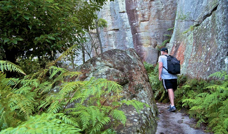
It’s such a treat to be able to take a bushwalk in the city. Look out for the amazing birdlife and enjoy the serenity of this short and easy walk.
- Distance
- 2km one-way
- Time suggested
- 20 - 30min
- Grade
- Grade 3
- What to
bring - Hat, drinking water, sunscreen
- Please note
- If you feel like a longer day walk, you can take the Two Valley trail from Campsie to Bexley North – it’s 13km in length, but there are some good places to stop for a coffee along the way
- Girahween picnic area at the Bardwell Park end of the walk is a good place to stop for a picnic or barbecue
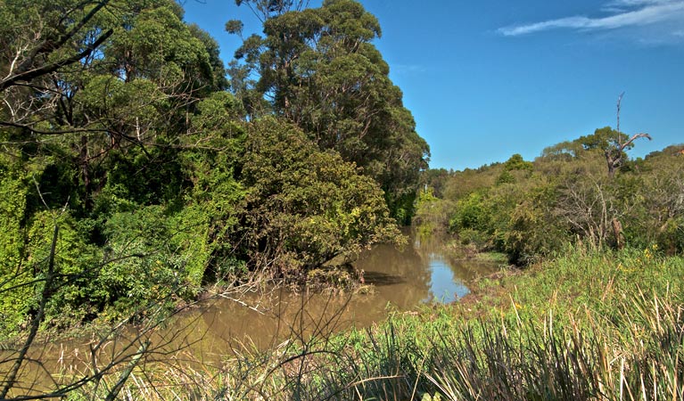
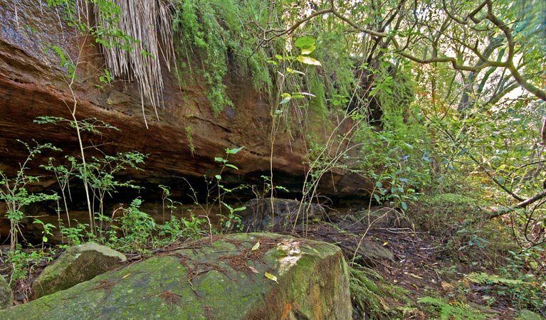
Wolli Creek walking track is a 2km section of the Two Valley trail, linking Campsie to Bexley North via a riverside trail that passes through Canterbury, Undercliffe and Bardwell Park. The park is a very special area, forming a vital vegetation corridor that assists native plants to survive because of its dense bush habitat for the insects and birds that pollinate the plants.
If you live in the local area, this short track is great for a brisk morning walk. Early morning and dusk are good times to spot the local wildlife; look for Australian pelicans hunting for fish, egrets with their long necks and tawny frogmouths camouflaged in the trees.
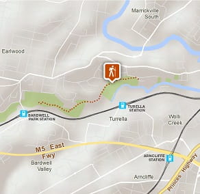
If you don’t live in the area, you can easily access this peaceful walk from one of the train stations along the route, including Turella, Bardwell Park, and Bexley North. The longer Two Valley trail can be accessed from a number of points along its 13km.
Google Street View Trekker
Using Google Street View Trekker, we've captured imagery across a range of NSW national parks and attractions. Get a bird's eye view of these incredible landscapes before setting off on your own adventure.

General enquiries
- National Parks Contact Centre
- 7am to 7pm daily
- 1300 072 757 (13000 PARKS) for the cost of a local call within Australia excluding mobiles
- parks.info@environment.nsw.gov.au
Operated by
- Nielsen Park office
- Monday to Friday, 9am to 5pm.
- 02 9337 5511
- npws.sydneysouth@environment.nsw.gov.au
- Greycliffe House, Nielsen Park, 6 Steele Point Road, Vaucluse NSW 2030
Park info
- in Wolli Creek Regional Park in the Sydney and surrounds region
Wolli Creek Regional Park is always open but may have to close at times due to poor weather or fire danger
What's nearby:
Things to do (53)
- Aboriginal culture (6)
- Beach (1)
- Birdwatching and wildlife encounters (8)
- Canoeing/paddling (5)
- Cultural heritage (4)
- Cycling (1)
- Educational activities (2)
- Fishing (5)
- Historic heritage (20)
- Photography (1)
- Picnics and barbecues (10)
- Sailing, boating and cruises (4)
- Sightseeing (14)
- Snorkelling and scuba (2)
- Swimming (5)
- Visitor centres (2)
- Walking (22)
- Wildflowers (seasonal) (3)