Turners walking track
Watagans National Park
Visitor info
All the practical information you need to know about Turners walking track.
Track grading
Features of this track
Distance
1km one-way
Time
30min - 1hr 30min
Quality of markings
Limited signage
Experience required
Experienced bushwalkers
Gradient
Short steep hills
Steps
No steps
Quality of path
Rough track, many obstacles
Getting there and parking
Get driving directions
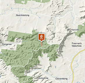
Turners walking track is in the northern precinct of Watagans National Park and can be accessed at either end of the trackhead. To get there:
Via Boarding House Dam picnic area:
- Boarding House Dam is located off Watagan Forest Road, approximately 2.5km south-west from the intersection of Mount Faulk Road.
Via Watagan Forest HQ in Heaten State Forest:
- Watagan Forest HQ is located on the corner of Watagan Road and Bakers Road, 3km north from the intersection of Mount Faulk Road.
Road quality
Check the weather before you set out as the road to Turners walking track can become slippery when it rains
Parking
Parking is available at either end of the track – Boarding House Dam picnic area in the south, or Watagan Forest HQ campground to the north. It can be a busy place on the weekend, so parking might be limited.
Best times to visit
There are lots of great things waiting for you in Watagans National Park.
Spring
Camp at Gap Creek or Bangalow campground and enjoy a campfire as the sun sets.
Summer
Cooling off at Boarding House Dam is especially popular during summer months Enjoy the moist and cool Circuit walking track .
Winter
Late winter sees the bloom of Illawara flame trees which can be seen across the valley from Gap Creek lookout Check out the views from the various lookouts, while the air is crisp and clean .
Weather, temperature and rainfall
Summer temperature
Average
16°C and 30°C
Highest recorded
44°C
Winter temperature
Average
5°C and 16°C
Lowest recorded
-6.7°C
Rainfall
Wettest month
December
Driest month
July
The area’s highest recorded rainfall in one day
91.4mm
Facilities
- Drinking water is limited or not available in this area, so it’s a good idea to bring your own.
- You’re encouraged to bring gas or fuel stoves, especially in summer during the fire season.
Maps and downloads
Prohibited
Pets
Pets and domestic animals (other than certified assistance animals) are not permitted. Find out which regional parks allow dog walking and see the pets in parks policy for more information.
Smoking
NSW national parks are no smoking areas.
Park info
- in Watagans National Park in the North Coast region
Watagans National Park is always open, but may have to close at times due to poor weather, roads closures or high fire danger.