The Drip walking track
Country NSW
Overview
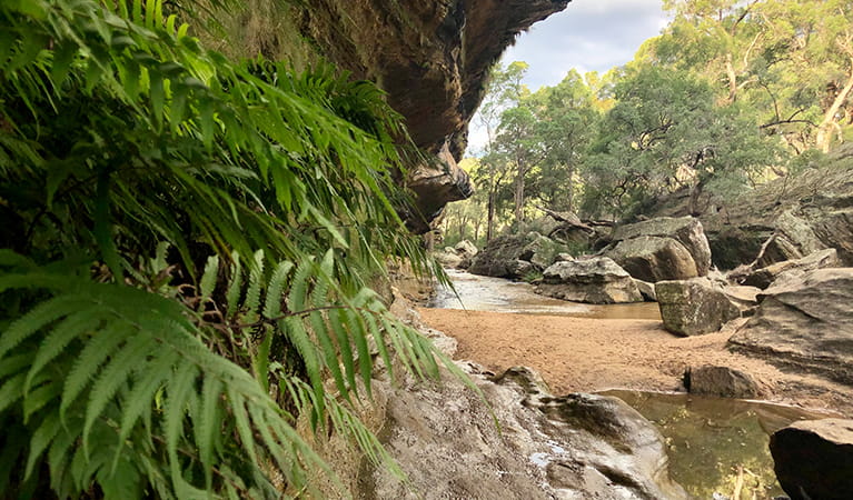
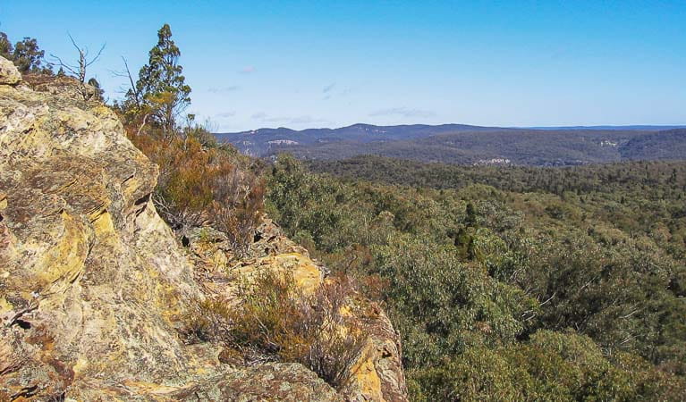
The Drip walking track, in Goulburn River State Conservation Area, meanders beside Goulburn River to The Drip, or 'the Great Dripping Wall’. Rain water trickling through the porous rock wall makes it a cool oasis.
- Accessibility
- No wheelchair access
- Distance
- 2.8km return
- Time suggested
- 1hr - 1hr 30min
- Grade
- Grade 3
- What to
bring - Hat, sunscreen, snacks, drinking water, sturdy shoes, suitable clothing
- Please note
- There are some steps, handrails, uneven rocks and creek crossings along this track. It’s a good idea to wear long pants and enclosed shoes.
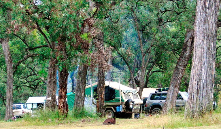
- You can visit The Drip during the day. If you’re camping, try Spring Gully or Big River campgrounds which are a 1 hour drive from The Drip, towards Wollar.
- No fires or camping are permitted at The Drip.
The Drip Gorge is a significant place for the local Wiradjuri People. The best time to experience it is after a few days of rain, when you’ll see the sandstone walls dripping clear spring water. During a hot summer you’ll love its natural air-conditioning. It can be 10 to 15° cooler than the surrounding region on a hot day. It usually has a light fall of rain from water percolating through the rock.
This return track starts and ends at the carpark. Pack a picnic then take off on a bushwalk. If you’re not feeling energetic, rest in the shade on a seat along the track or dip your feet in the quiet rockpools.
The abundant plant life along the track adds to the beauty of The Drip. See if you can spot native apple gums, tree violets (named for their scent) and rocky outcrops with orchids and moss. After your walk, splash around in the Goulburn River or stop off at Hands on the Rock, an important Aboriginal rock art site at Ulan. It’s only 2km north of the Drip and well worth a visit.
Map
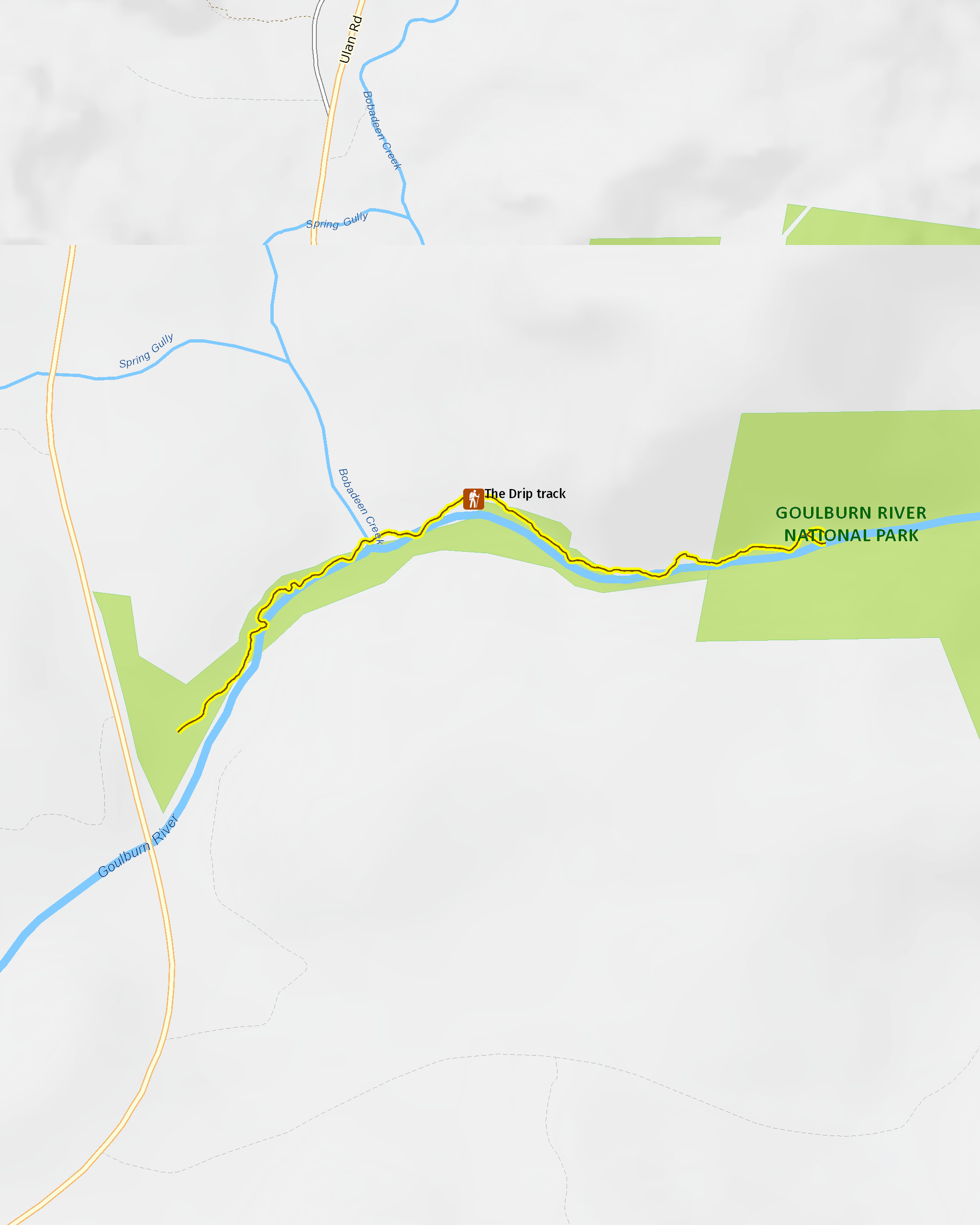
Map legend

Local alerts
For the latest updates on fires, closures and other alerts in this area, see https://www.nationalparks.nsw.gov.au/things-to-do/walking-tracks/the-drip-walking-track/local-alerts
General enquiries
- National Parks Contact Centre
- 7am to 7pm daily
- 1300 072 757 (13000 PARKS) for the cost of a local call within Australia excluding mobiles
- parks.info@environment.nsw.gov.au
Park info
- in Goulburn River National Park in the Country NSW region
Goulburn River National Park is always open, but may have to close at times due to poor weather or fire danger.
- in Goulburn River State Conservation Area in the Country NSW region
Visitor info
All the practical information you need to know about The Drip walking track.
Track grading
Features of this track
Distance
2.8km return
Time
1hr - 1hr 30min
Quality of markings
Clearly sign posted
Experience required
No experience required
Gradient
Short steep hills: The walk has many steep hills
Quality of path
Formed track: The walk is 1m-wide, and hard-packed ground and rock along its length.
Steps
Occasional steps: There are sets of steps, ranging from between 3 steps and 19 steps each, all the way along the track.
Some of the steps are timber and others are stone. Only one of the sets of steps has handrails.
Other barriers
Gates: There are 2 locked vehicle gates at the start of the walk, but there's pedestrian access next to the gate.
Pinch points: There may be points where the track narrows due to rocks, tree roots and plants.
The track also narrows to 0.8m-wide at the pedestrian bridge towards the start of the walk.
Other barriers: There's a set of stepping stones across Bobadeen Creek.
Getting there and parking
The Drip is in Goulburn River State Conservation Area, on the extreme western boundary of Goulburn River National Park. To get there from Mudgee:
- Drive around 50km north from Mudgee on Ulan-Cassilis Road.
- Pass by the Ulan and Moolarben coal mines and drive for another 10km.
- Look for the turn-off sign for The Drip, just north of the Ulan mine precinct towards the Golden Highway.
Weather restrictions
- All weather
Parking
There's parking off Ulan-Cassilis Road in The Drip carpark, which is a bitumen carpark. Limited parking is available, and there are also spaces for caravans and small buses. The carpark is not suitable for large coaches.
Note: Ulan-Cassilis Road is a 100km/hr road. Take care when entering and leaving The Drip carpark. Avoid parking on Ulan-Cassilis Road, as it is very dangerous to cross.
Facilities
- The toilets and picnic tables are located at the carpark.
- Drinking water is not available. It's a good idea to bring your own drinking water.
Toilets
There's an double-bay ambulant toilet a short walk from the carpark where the walk begins.
- Non-flush toilets
Picnic tables
Seats and resting points
There's a bench seat with a backrest shortly after the track crosses Bobadeen Creek.
Maps and downloads
Accessibility
Disability access level - no wheelchair access
The Drip walking track may be challenging for people with reduced mobility:
- The walk has many short, steep hills and over 250 steps in sets that range from between 3 to 19 steps each. Only one of these sets of steps has a handrail.
- There's a creek crossing with stepping stones
- There may be points where the track narrows due to rocks, tree roots and plants. It also narrows to 0.8m-wide at the pedestrian bridge near the start of the walk.
The carpark and picnic area are wheelchair-accessible and there's a double-bay ambulant toilet a short, gentle walk from the carpark.
Prohibited
Camp fires and solid fuel burners
Camping
Pets
Pets and domestic animals (other than certified assistance animals) are not permitted. Find out which regional parks allow dog walking and see the pets in parks policy for more information.
Smoking
NSW national parks are no smoking areas.
Learn more
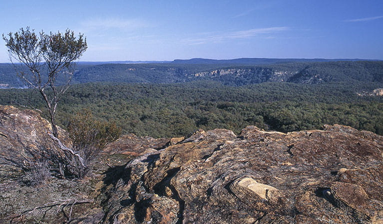
The Drip walking track is in Goulburn River National Park. Here are just some of the reasons why this park is special:
Aboriginal echoes
For many thousands of years before European settlement, the river valley that runs through Goulburn River National Park was an important trading route between the Aboriginal people who resided on the coast, and those who lived on the western plains. The area was traditionally occupied by the people of the Wiradjuri, Gamileroi and Wonnarua Clans, and today more than 300 known Aboriginal sites remain within the park, mainly along the river.
- Aboriginal cultural tours of Wiradjuri Country Journey through the Australian bush on a guided tour of Wiradjuri Country with Milan Dhiiyaan. Learn about Aboriginal culture, share in a smoking ceremony and find local bush tucker in Goulburn River National Park.
- The Drip walking track The Drip walking track, in Goulburn River State Conservation Area, meanders beside Goulburn River to The Drip, or 'the Great Dripping Wall’. Rain water trickling through the porous rock wall makes it a cool oasis.
Action aplenty
Along the Goulburn River, there are plenty of outdoor pursuits to keep you busy. The river is usually shallow but offers natural pools that are suitable for swimming. After rain, its gentle flow makes canoeing and liloing possible. There are lots of walking opportunities in Goulburn River National Park, like Lees Pinch lookout track or the marked fire trails, which can be explored on foot or on a mountain bike.
- Spring Gully drive The picturesque Spring Gully drive takes you through lush forest. At Spring Gully campground, you can enjoy a swim, fishing and birdwatching.
Forest landscape
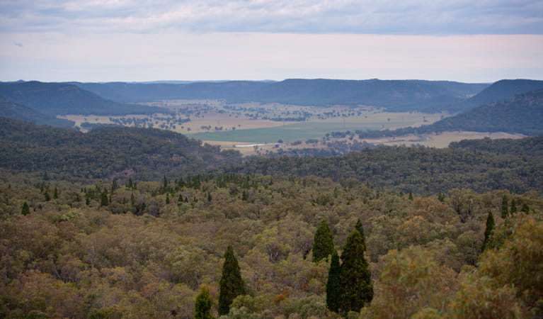
The park, covering over 70,000ha, was established in 1983 following the decision that the land was precious, both environmentally and culturally, especially for the traditional Aboriginal owners. Visiting the park today, you'll admire the sheer magnificence of Goulburn River National Park, due to its preservation as a forest landscape, much of which is surrounded by pastoral land.
- Big River drive Big River drive leads to Big River campground in Goulburn River National Park. Get in your car for fishing, swimming and camping.
- Spring Gully drive The picturesque Spring Gully drive takes you through lush forest. At Spring Gully campground, you can enjoy a swim, fishing and birdwatching.
- The Drip walking track The Drip walking track, in Goulburn River State Conservation Area, meanders beside Goulburn River to The Drip, or 'the Great Dripping Wall’. Rain water trickling through the porous rock wall makes it a cool oasis.
Wild about the park
With its location along the river, surrounded by rural holdings, Goulburn River is rich in plant and wildlife. Kangaroos, wallabies and wallaroos are often seen grazing on the riverbanks. A rich variety of plant life - eucalypts, river oak, grevilleas and callistemon (more commonly called bottlebrush) - provides habitats for many birds, including glossy black cockatoos and lyrebirds.
- Big River drive Big River drive leads to Big River campground in Goulburn River National Park. Get in your car for fishing, swimming and camping.
- Spring Gully drive The picturesque Spring Gully drive takes you through lush forest. At Spring Gully campground, you can enjoy a swim, fishing and birdwatching.