Pretty Beach to Pebbly Beach walking track
Murramarang National Park
Overview
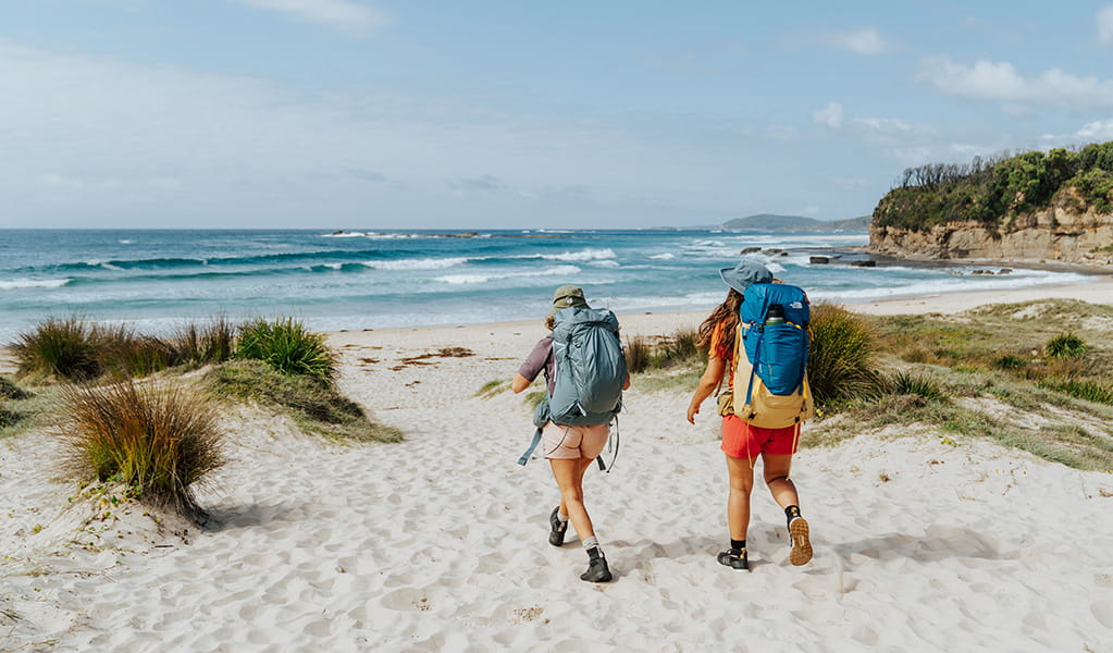
Pretty Beach to Pebbly Beach walking track follows the coast along rock platforms, isolated beaches and through coastal forest.
- Where
- Murramarang National Park in South Coast
- Accessibility
- No wheelchair access
- Distance
- 8km one-way
- Time suggested
- 3 - 5hrs
- Grade
- Grade 4
- Trip Intention Form
-
It's a good idea to let someone know where you're going. Fill in a trip intention form to send important details about your trip to your emergency contact.
- Entry fees
- Park entry fees apply
- What to
bring - Drinking water, food supplies, sturdy shoes, clothes for all weather conditions, sunscreen, hat
If you're well prepared, Pretty Beach to Pebbly Beach walking track is an adventurous full day hike that traces the rocky coastline and beaches of northern Murramarang National Park.
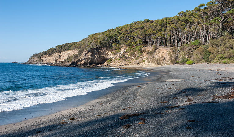
Heading south from Pretty Beach, follow the coast across potentially slippery rock shelfs, which are at times underwater, and along remote pebble beaches. Make sure to check tides, swells and weather conditions before you set out as the journey requires extreme caution and is inaccessible from mid to high tide. It should not be attempted during poor weather or big ocean swells.
At Snake Bay, cool off with a swim in the clear ocean before tucking into a beachside picnic.
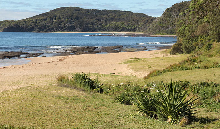
The walk from Snake Bay is through coastal forest with spectacular views of the ocean through the trees and with views back to Pretty Beach. The track remains on the headland with undulating hills and glimpses of the sea through spotted gum forest until you reach Pebbly Beach.
Take a virtual tour of Pretty Beach to Pebbly Beach walking track captured with Google Street View Trekker.
Map
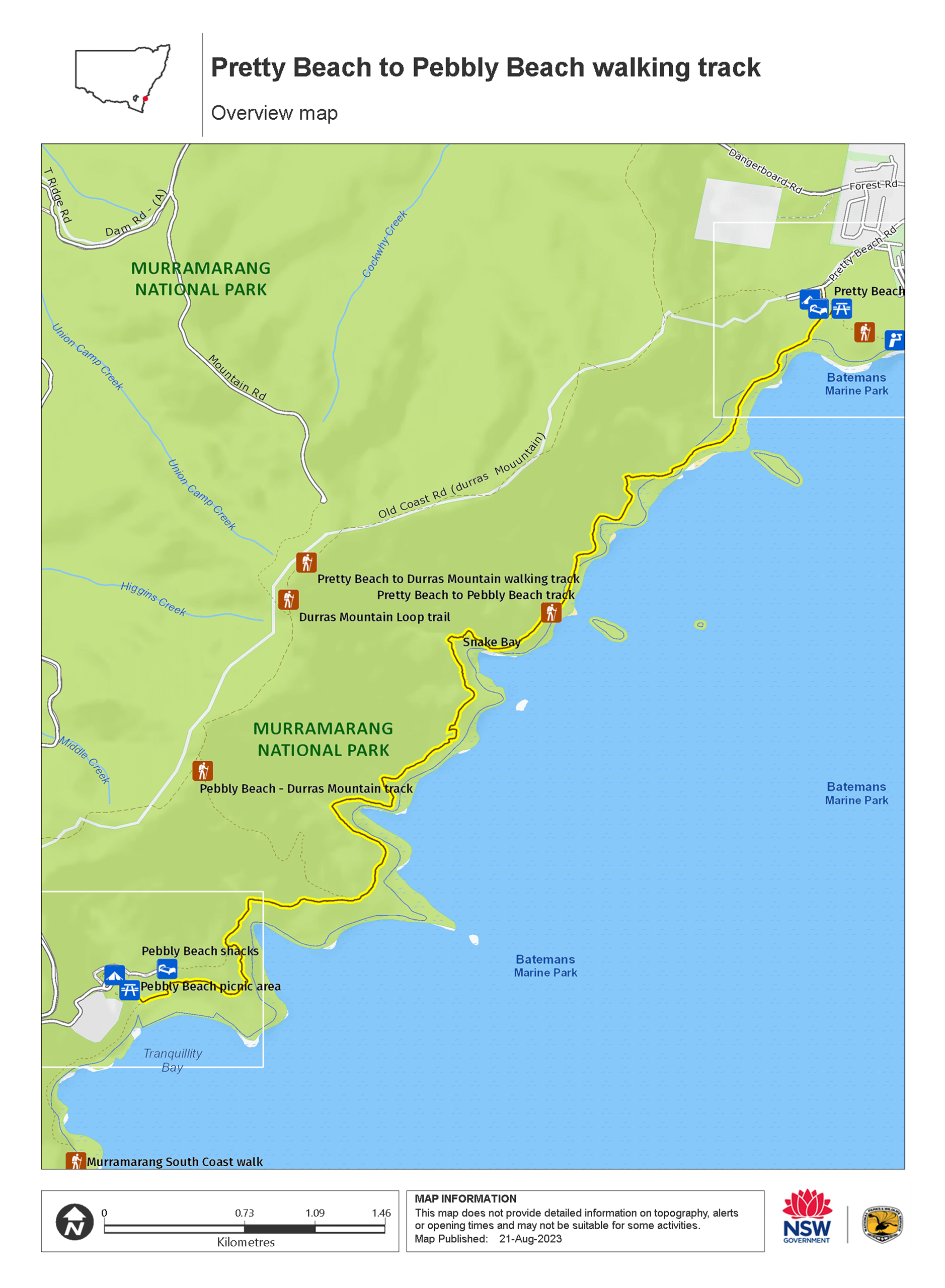
Map
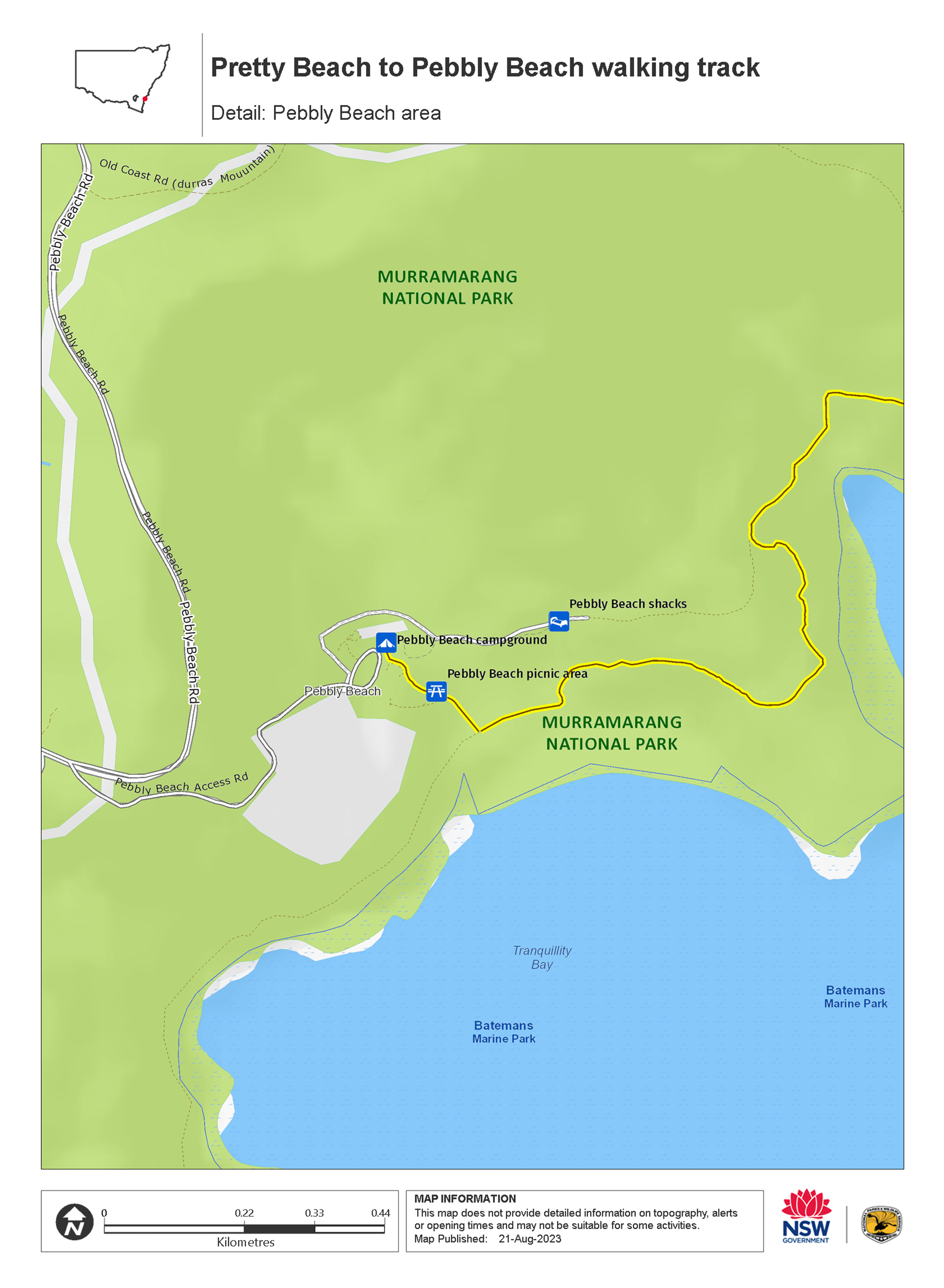
Map
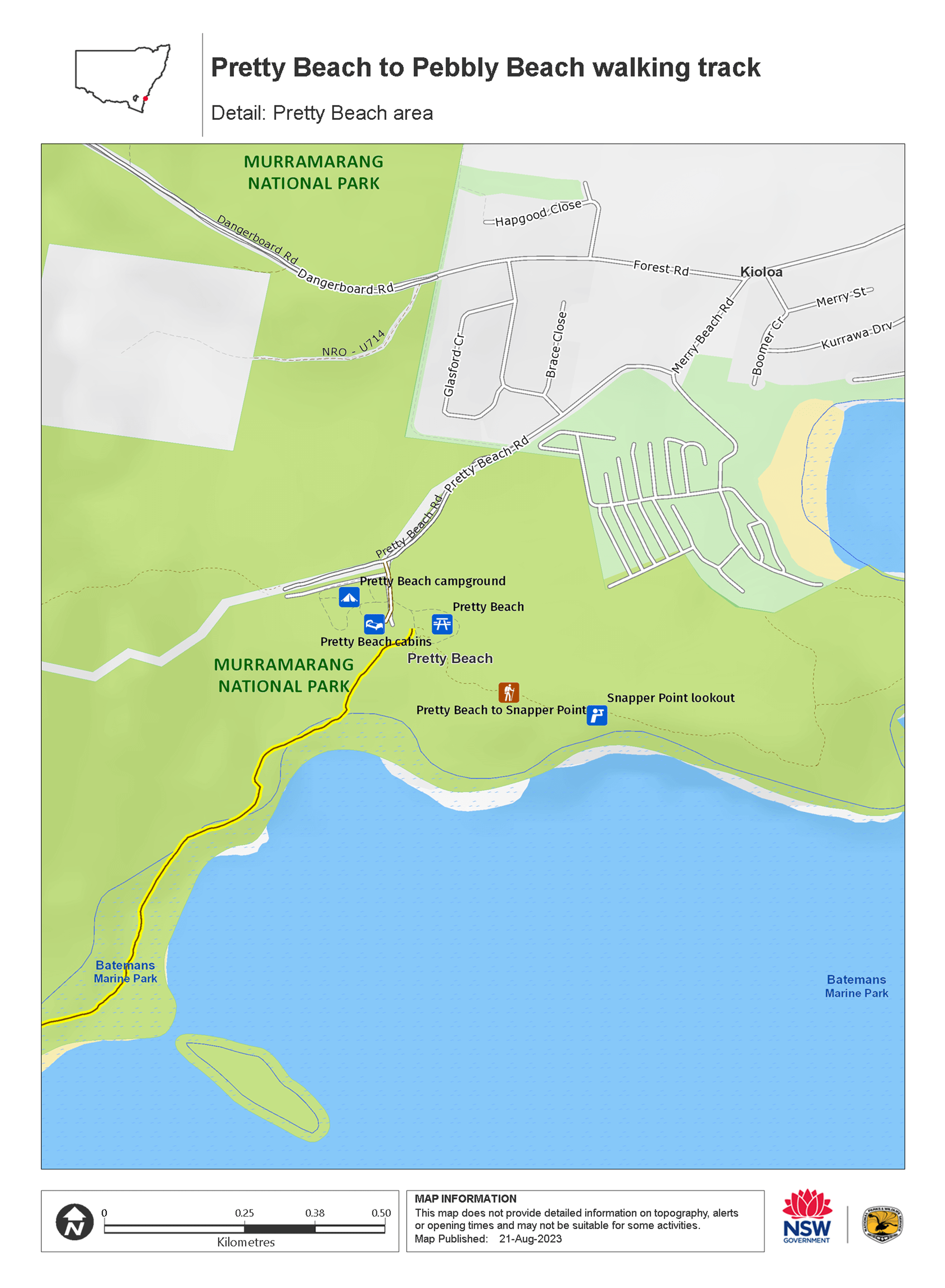
Map legend

Local alerts
For the latest updates on fires, closures and other alerts in this area, see https://www.nationalparks.nsw.gov.au/things-to-do/walking-tracks/pretty-beach-to-pebbly-beach-walking-track/local-alerts
General enquiries
- National Parks Contact Centre
- 7am to 7pm daily
- 1300 072 757 (13000 PARKS) for the cost of a local call within Australia excluding mobiles
- parks.info@environment.nsw.gov.au
Park info
- in Murramarang National Park in the South Coast region
Murramarang National Park is always open but may have to close at times due to poor weather or fire danger.
-
Park entry fees:
$8 per vehicle per day. The park has pay machines - cash and credit cards accepted. Card only at Pretty Beach.
Buy annual pass
Visitor info
All the practical information you need to know about Pretty Beach to Pebbly Beach walking track.
Track grading
Features of this track
Distance
8km one-way
Time
3 - 5hrs
Quality of markings
Clearly sign posted
Experience required
Experienced bushwalkers
Gradient
Gentle hills
Steps
Occasional steps
Quality of path
Rough track, many obstacles
Getting there and parking
Pretty Beach to Pebbly Beach walking track is in the northern part of Murramarang National Park. To get there:
- Enter the park off the Princes Highway at Termeil
- Take the Bawley Point/Kioloa turn off
- Drive past Kioloa and follow the signs to Pretty Beach
Road quality
- Mixture of sealed and unsealed roads
Vehicle access
- 2WD vehicles
Weather restrictions
- All weather
Parking
Parking is available at Pretty Beach picnic area.
Facilities
This walk is in an isolated location. There are toilet and picnic facilities at the start and end of the walk at Pretty Beach picnic area and Pebbly Beach picnic area.
Maps and downloads
Accessibility
Disability access level - no wheelchair access
Prohibited
Fishing
Pets
Pets and domestic animals (other than certified assistance animals) are not permitted. Find out which regional parks allow dog walking and see the pets in parks policy for more information.
Smoking
NSW national parks are no smoking areas.
Learn more
Pretty Beach to Pebbly Beach walking track is in Murramarang National Park. Here are just some of the reasons why this park is special:
Bird watching
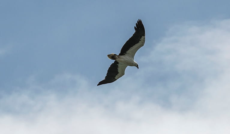
Birdwatchers are in for a treat; the park boasts more than 90 species of birdlife including three owl species, peregrine falcons, sea eagles, gannets, shearwaters, white-faced storm petrels, sooty oystercatchers, eastern yellow robins, satin bowerbirds, the rufous fantail and even a penguin colony. Look for the sea eagles and peregrine falcons soaring above the park’s cliffs and headlands and the rufous fantails and eastern yellow robins in rainforest gullies around Durras Mountain. You’re most likely to see sooty oystercatchers wading around the edges of lake areas.
Native animals
There’s an abundance of wildlife living in Murramarang National Park, but by far one of the highlights is seeing eastern grey kangaroos that spend their days dozing near the beaches and by campgrounds until dusk when they gather to feed. In the moist forests of the park you might see lyrebirds fossicking in leaf litter. Look for the stately, strutting wonga pigeon with its pastel blue-grey back feathers and black dotted stomach. If you don’t see it, you may well hear its repetitive, deep ‘whoop, whoop’ call that carries through the forest.
- Burrawang walking track Burrawang walking track, across Depot Beach Headland, features scenic coastal views, forests and birdwatching in Murramarang National Park, near Batemans Bay.
- Richmond Beach Richmond Beach is one of Murramarang’s hidden treasures. Just 50m from the carpark on an easy walking track you can enjoy picnicking, swimming, snorkelling, fishing and paddling.
Native vegetation
One of the really special things in Murramarang is the forest of majestic spotted gums; it’s one of the biggest continuous stands in NSW. With an understorey of burrawang palms, the forest stretches right down to the ocean and is truly a sight to see. You’ll easily recognise the spotted gums – they have a smooth, dimpled bark which is shed in summer to produce a mottled cream and grey ‘spotted’ appearance.
- Dark Beach walking track Dark Beach walking track leads to a secluded beach with unique rock formations in Murramarang National Park. Ideal for fishing, swimming and snorkelling.
- Depot Beach Rainforest walk Depot Beach marks the start and end of this easy walk through lush littoral rainforest. Go for a swim, surf, snorkel or paddle in the clear waters when you return.
- Rock Platform walk - Depot Beach Rock Platform walk near Depot Beach is a short walk to fascinating rockpools offering excellent birdwatching and scenic ocean views of the South Coast, just north of Batemans Bay.
Rich Aboriginal cultural heritage
Aboriginal people have a long connection with the Country of Murramarang National Park, and this continues to the present day. The south coast headlands have long been a focus for economic life, giving easy access to the food resources of both the sea and the land, and plants within the park provided medicines and shelter. There is much evidence of the past today, including shell middens, tool manufacturing sites and indications of a specialised industry producing bone points and fishing hooks. Take a walk around Murramarang Aboriginal Area, near Bawley Point - there's a complex of middens that are of great cultural value.
- Then and now: Aboriginal culture Aboriginal culture then and now is a Stage 2 (Years 3-4) school excursion in Murramarang National Park, focusing on Geography and History. Through story and creative expression, the life and culture of the local people are shared.
- Then and now: Aboriginal culture Then and now: Aboriginal culture is a Stage 4 (Years 7-8) school excursion in Murramarang National Park, focused on History. Through story and creative expression, the life and culture of the local people are shared.
- Then and now: Aboriginal culture This excursion experience has been updated and is now being delivered in line with the new NSW Department of Education Curriculum. We will be revising this excursion's name and information online soon. Contact your local national parks office for more information about the updated excursion.
- Wasp Head walk This short walk leads to a spectacular view of Wasp Island and passes through historic Aboriginal sites of the area.
Plants and animals protected in this park
Animals
-
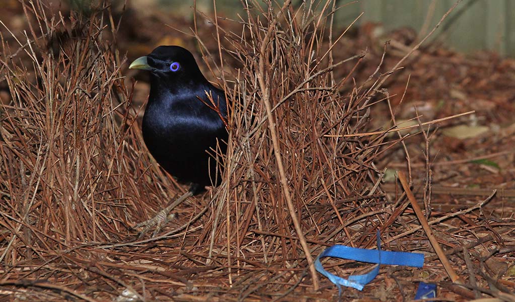
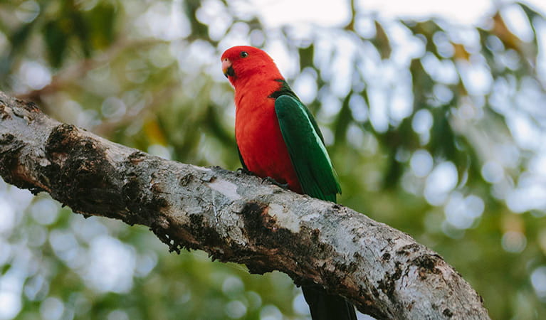
Satin bowerbird (Ptilonorhynchus violaceus)
With vibrant blue-violet eyes and curious antics, the satin bowerbird is a favourite for bird watching and easy to spot as it forages for food in open forest. Relatively common across eastern Australia, in NSW they’re found in coastal rainforests and adjacent woodlands and mountain ranges.
Plants
-
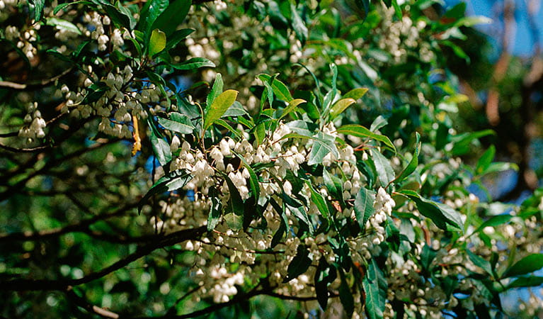
Blueberry ash (Elaeocarpus reticulatus)
The blueberry ash is a rainforest shrub which produces blue olive-shaped berries and spectacular bell-shaped flowers, which often appear on the plant together. It is a tall slender shrub or small tree found in rainforest, tall eucalypt forest and coastal bushland in eastern NSW, south-east Queensland and Victoria.
-
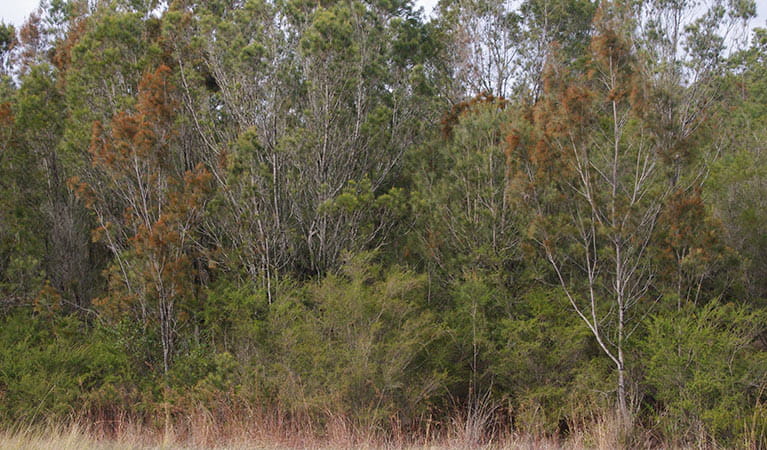
Black sheoak (Allocasuarina littoralis)
The black sheoak is one of a number of casuarina species found across the east coast of Australia and nearby tablelands. Growing to a height of 5-15m, these hardy Australian native plants can survive in poor or sandy soils. The barrel-shaped cone of the black sheoak grows to 10-30mm long.
-
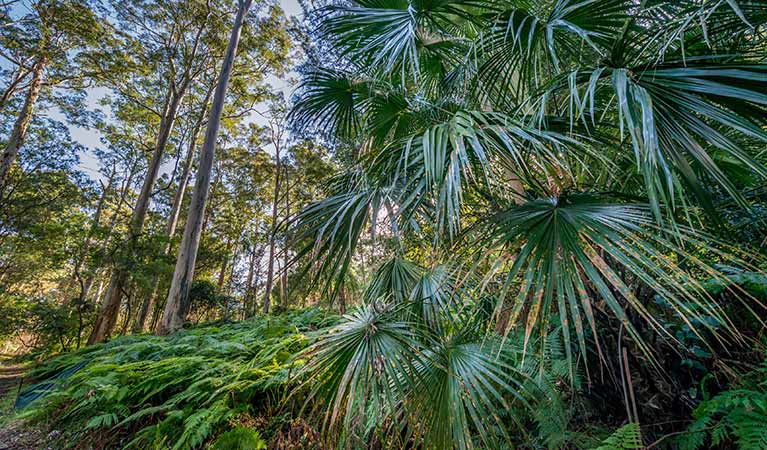
Cabbage palm (Livistona australis)
With glossy green leaves spanning 3-4m in length and a trunk reaching a height of up to 30m, the cabbage tree palm, or fan palm, is one of the tallest Australian native plants. Thriving in rainforest margins along the east coast of NSW, in summer this giant palm produces striking spikes of cream flowers which resemble cabbages.
-
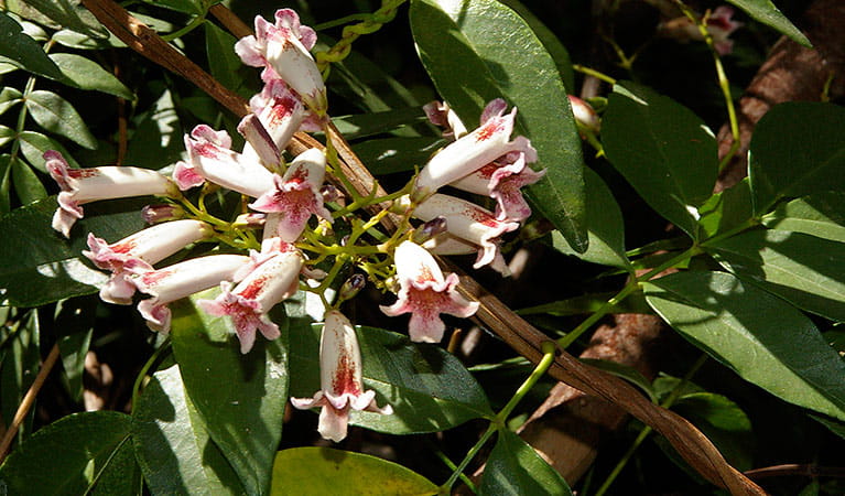
Wonga wonga vine (Pandorea pandorana)
The wonga wonga vine is a widespread vigorous climber usually found along eastern Australia. A variation of the plant occurs in the central desert, where it resembles a sprawling shrub. One of the more common Australian native plants, the wonga wonga vine produces bell-shaped white or yellow flowers in the spring, followed by a large oblong-shaped seed pod.
Environments in this park
Education resources (1)
School excursions (3)
General enquiries
- National Parks Contact Centre
- 7am to 7pm daily
- 1300 072 757 (13000 PARKS) for the cost of a local call within Australia excluding mobiles
- parks.info@environment.nsw.gov.au
Operated by
- Ulladulla office
- Monday to Friday, 9am to 4pm.
- 02 4454 9500
- npws.shoalhaven@environment.nsw.gov.au
- Lot 9 Blackburn Industrial Estate, 6 Coller Road Ulladulla NSW 2539
Park info
- in Murramarang National Park in the South Coast region
Murramarang National Park is always open but may have to close at times due to poor weather or fire danger.
-
Park entry fees:
$8 per vehicle per day. The park has pay machines - cash and credit cards accepted. Card only at Pretty Beach.
Buy annual pass
What's nearby:
Things to do (69)
- Aboriginal culture (5)
- Adventure sports (1)
- Beach (3)
- Birdwatching and wildlife encounters (35)
- Canoeing/paddling (12)
- Fishing (16)
- Historic heritage (4)
- Horse riding (1)
- Picnics and barbecues (18)
- Road trips and car/bus tours (2)
- Sailing, boating and cruises (1)
- Sightseeing (37)
- Snorkelling and scuba (9)
- Surfing (7)
- Swimming (23)
- Walking (38)
- Waterfalls (2)
- Wildflowers (seasonal) (2)