Helmholtzia loop walking track
Border Ranges National Park
Overview
Helmholtzia loop walking track, in Border Ranges National Park, is a short easy walk through lush rainforest of beech and hoop pines. It also offers great birdwatching opportunities.
- Where
- Border Ranges National Park in North Coast
- Accessibility
- Hard
- Distance
- 1km loop
- Time suggested
- 20 - 40min
- Grade
- Grade 3
- Entry fees
- Park entry fees apply
- What to
bring - Hat, sunscreen
- Please note
- It's a good idea to fill your fuel tank before heading out to the park as the closest service stations are Kyogle, Woodenbong, Nimbin and Rathdowney.
- The weather in the area can be extreme and unpredictable, so please ensure you're well-prepared for your visit.
- Remember to take your binoculars if you want to go birdwatching
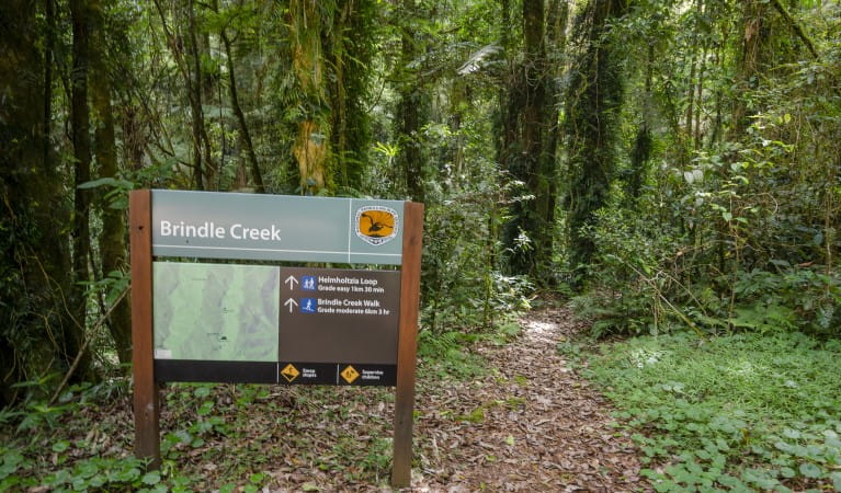
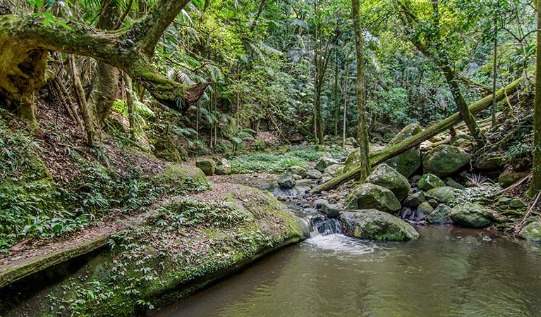
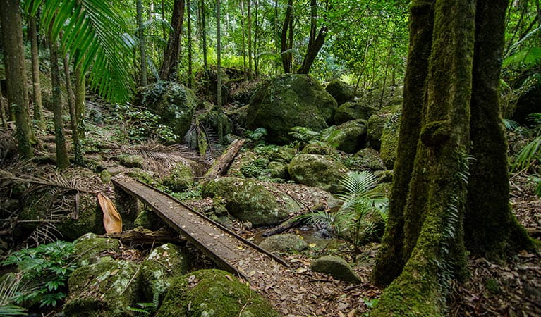
Helmholtzia loop walking track takes you on a short, easy walk through a beautiful section of Border Ranges National Park. It takes you across pristine Brindle Creek on low bridges and into World Heritage rainforest.
The name of this track comes from the helmholtzia plant that grows in the area. Also referred to as the stream lily, this rare plant is found only in the rainforest of north-east NSW and south-east Queensland. Helmholtzia are large strap-leafed plants which require a reliable water supply and are usually found along the banks of creeks and in gullies.
Helmholtzia loop walking track is also home to hoop pines, stands of Antarctic beech and abundant epiphytes - a plant that grows on another without being a parasite, while sourcing moisture and nutrients from the atmosphere and nearby debris.
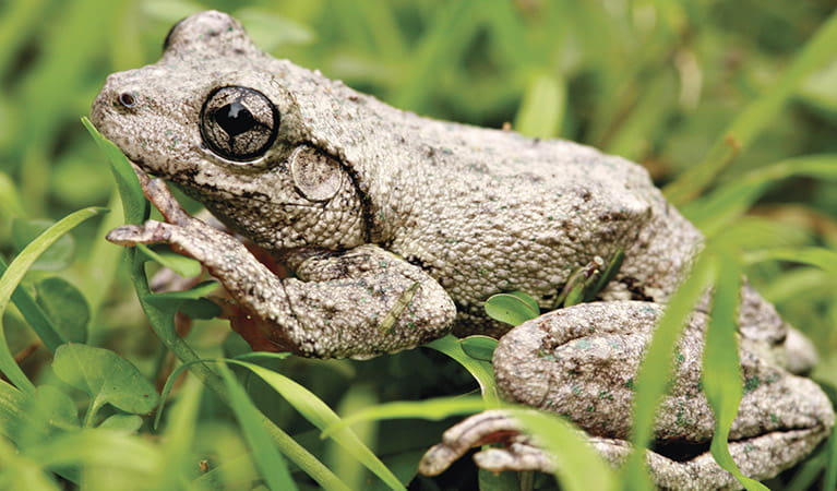
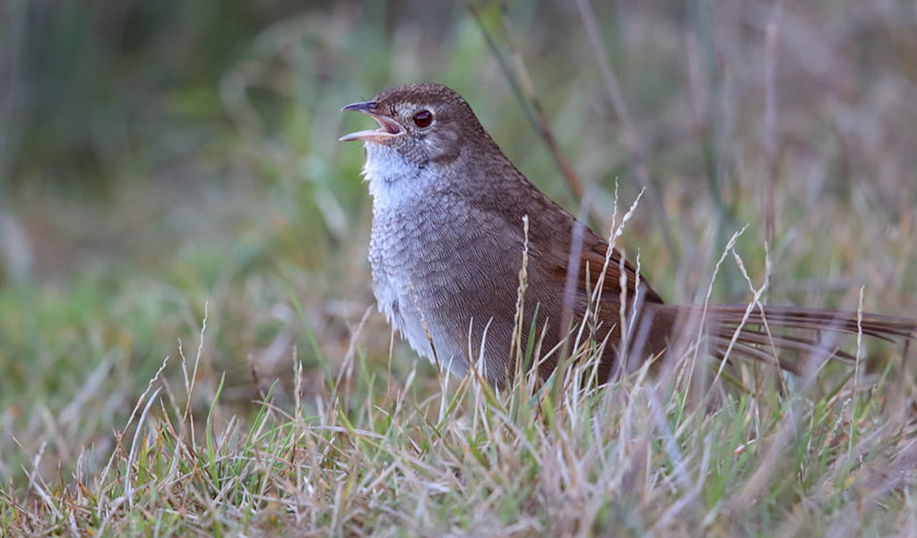
Be sure to bring your binoculars along for a spot of birdwatching and keep your eyes and ears out for some endangered frog species including Fleay's barred frog and pouched frog.
Take a virtual tour of Helmholtzia loop walking track captured with Google Street View Trekker.
You might also like
-
Border Ranges 360 experiences
Discover some of the rare and remarkable animals, plants and habitats that make Border Ranges National Park special, with our interactive 360-degree images.
Map
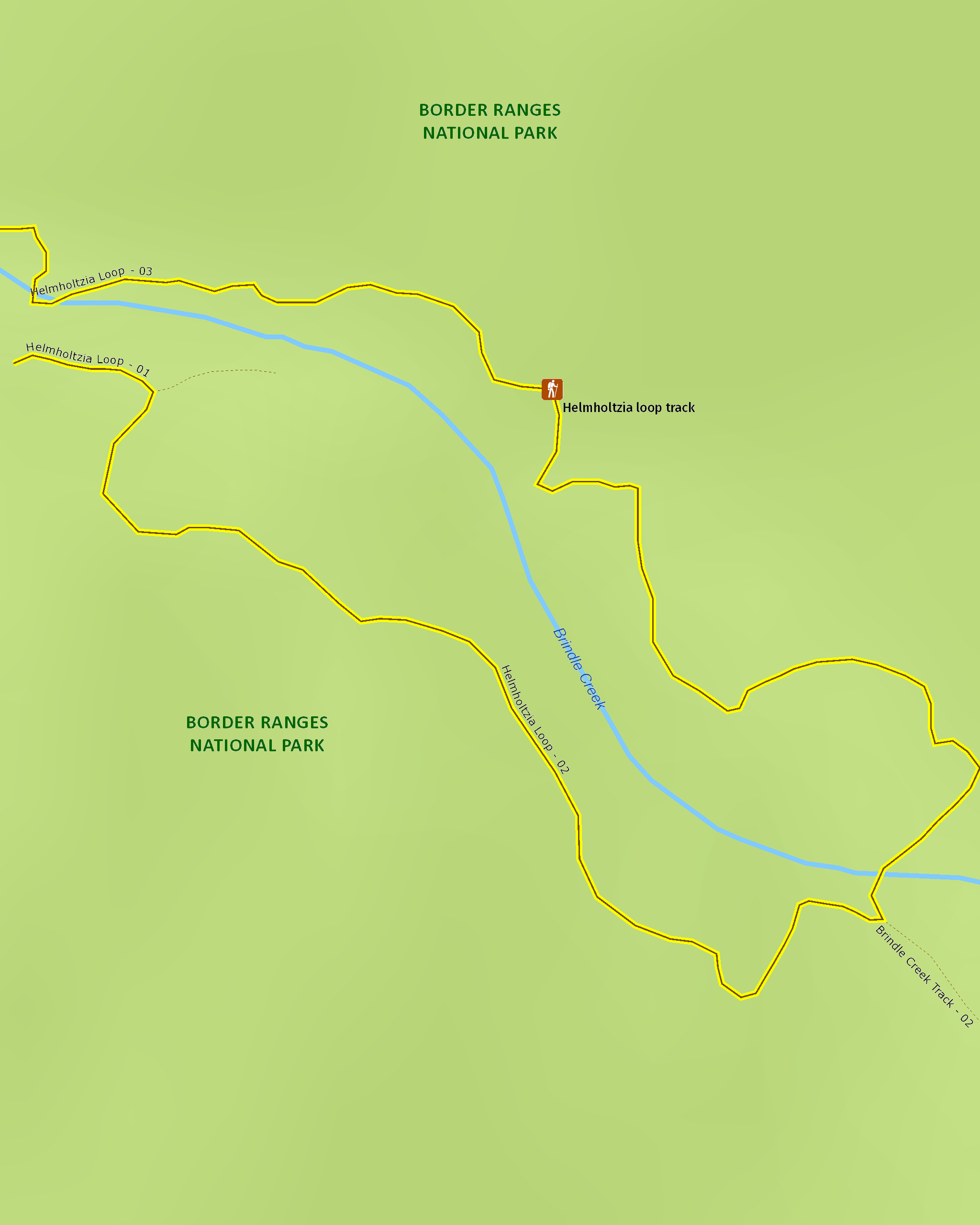
Map legend

Local alerts
For the latest updates on fires, closures and other alerts in this area, see https://www.nationalparks.nsw.gov.au/things-to-do/walking-tracks/helmholtzia-loop-walking-track/local-alerts
General enquiries
- National Parks Contact Centre
- 7am to 7pm daily
- 1300 072 757 (13000 PARKS) for the cost of a local call within Australia excluding mobiles
- parks.info@environment.nsw.gov.au
Park info
- in Border Ranges National Park in the North Coast region
Border Ranges National Park is always open but may have to close at times due to poor weather or fire danger.
-
Park entry fees:
$8 per vehicle per day.
Buy annual pass.
Visitor info
All the practical information you need to know about Helmholtzia loop walking track.
Track grading
Features of this track
Distance
1km loop
Time
20 - 40min
Quality of markings
Clearly sign posted
Experience required
No experience required
Gradient
Gentle hills: The walk has gentle hills until you reach the steps that go down to the creek and back up the opposite bank. This section of the track is moderately steep.
Quality of path
Formed track, some obstacles: The walk is 0.5-1m-wide and hard-packed ground along its length.
Steps
Occasional steps: As the loop approaches its eastern-most point there are 3 sets of steps, ranging from between 15 to 26 steps each. The steps are irregular and some may have a higher than normal step up or down.
At the start of the northern part of the loop, there's also a set of 3 steps.
Most steps are made of timber, but there are also some irregular natural stone steps.
Other barriers
Pinch points: There are several pedestrian bridges along the walk that narrow the width of the track to 0.4m-wide. The bridges are timber, do not have handrails and some lead across Brindle Creek.
Plants, trees and boulders may also cause the track to narrow in some sections.
Accessible options
The first 100m of the southern part of the loop and the first 50m of the northern part of the loop walk may be accessible for people with reduced mobility.
Getting there and parking
Helmholtzia loop walking track is in the eastern precinct of Border Ranges National Park. To get there:
From Murwillumbah:
- Travel south-west on Kyogle Road to Lillian Rock, then turn right onto Williams Road.
- Travel along Williams Road for 2.5km, then Creegans Road for 6km, until you reach the park boundary.
- From the boundary, continue 26km along Tweed Range Scenic Drive to Brindle Creek Road intersection, then turn right.
- Travel 2km to Brindle Creek carpark
From Kyogle:
- Travel north along Summerland Way for 14km until you reach Wiangaree
- Turn right at Wiangaree into Lynches Creek Road and travel east for 12km to Forest Road
- Turn right onto Forest Road and continue 4.5km to the park boundary
- From the boundary, continue on Tweed Range Scenic Drive for 6.5km and then turn left onto Bridle Creek Road.
- Travel 2km to Brindle Creek carpark
Vehicle access
- 2WD vehicles
Weather restrictions
- 4WD required in wet weather
Parking
Parking is available on unsealed Brindle Creek Road at Brindle Creek picnic area where this walk begins.
Best times to visit
There are lots of great things waiting for you in Border Ranges National Park. Here are some of the highlights.
Autumn
A picnic at Border Loop lookout and picnic area is a must during autumn. It's also a popular spot to see the historic Border Loop railway line.
Spring
The perfect time to get away from it all on a family camping trip. Sheepstation Creek campground is a great base for exploring Border Ranges National Park.
Summer
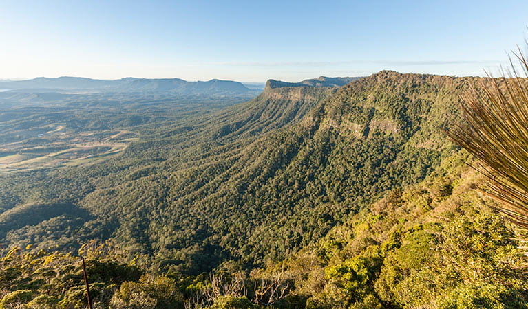
Watching the sunrise from Pinnacle lookout offers the best views of the crater escarpment, Wollumbin-Mount Warning and the coast. You're bound to find it a breathtaking experience.
Winter
Take in the park's scenery from the comfort of your car or motor home as you drive along the Tweed Range Scenic drive. Be sure to take some breaks along the way though – you don't want to miss the views.
Weather, temperature and rainfall
Summer temperature
Average
18°C and 30°C
Highest recorded
42.9°C
Winter temperature
Average
8°C and 22°C
Lowest recorded
-0.3°C
Rainfall
Wettest month
February
Driest month
September
The area’s highest recorded rainfall in one day
321mm
Facilities
Accessible non-flush toilets and picnic tables are located at Brindle Creek picnic area, where this walk begins.
Maps and downloads
Accessibility
Disability access level - hard
Helmholtzia loop walking track is 0.5-1m wide and hard-packed ground.
The first 100m of the southern part of the loop and the first 50m of the northern part of the loop may be accessible for people with reduced mobility.
After this, there are parts of the track that people with reduced mobility may find difficult to navigate:
- There are many steps in the eastern part of the loop that can be irregular and higher than normal steps. Most are made of timber, but there are also some natural stone steps.
- There are pedestrian bridges that narrow the track to 0.4m-wide. The bridges don't have handrails and some go across Brindle Creek.
- Plants, trees and boulders may cause the track to narrow.
- There's a section of the track that's moderately steep, with steps that go down to the creek and back up the opposite bank.
Prohibited
Pets
Pets and domestic animals (other than certified assistance animals) are not permitted. Find out which regional parks allow dog walking and see the pets in parks policy for more information.
Smoking
NSW national parks are no smoking areas.
Learn more
Helmholtzia loop walking track is in Border Ranges National Park. Here are just some of the reasons why this park is special:
Aboriginal heritage
The dramatic landscapes of the Border Ranges National Park echo the historical ties connecting the region's Aboriginal people to Country. The Githabul People trace their identity and spirituality to this Country and it is central to their Dreaming. The park protects many ancient sites and continues to be a place of great significance today.
Abundant wildlife
Being part of the Gondwana Rainforests of Australia World Heritage Area, makes this park a truly special place to visit. This region has the highest concentration of marsupial, bird, snake and frog species in Australia, so you're bound to come across a cute creature or two during your visit. While you're in the heart of this remarkable rainforest make sure you listen out for the call of the Alberts lyrebird, and while you're picnicking, keep your eye out for the rare, local fauna that thrive in this lush, protected wilderness.
- Border Loop walk Walk the short and easy Border Loop walk through World Heritage-listed rainforest. Enjoy spectacular views from the lookout and finish with a picnic at the end.
- Border Ranges 360 experiences Discover some of the rare and remarkable animals, plants and habitats that make Border Ranges National Park special, with our interactive 360-degree images.
Picture perfect
A landscape photographer's dream, you'll be spoilt for choice in trying to capture the sheer scale and beauty of this epic rainforest from the many lookouts dotted throughout the park. Be sure to carry your camera up to the Pinnacle lookout at sunrise for a breathtaking birds-eye view of the crater escarpment all the way down to the NSW coastline. Don't forget to change your camera setting to panoramic for the perfect mantelpiece shot.
World Heritage wonder
The rainforests of the Border Ranges National Park are part of the Gondwana Rainforests of Australia World Heritage Area. World Heritage Areas are irreplaceable sources of life and inspiration - places of such value that the international community has agreed they must be conserved for all time. You can explore this World Heritage-listed rainforest on one of the many walking tracks, like the short Pinnacle walk that provides spectacular views of Wollumbin and the Tweed Valley 1km below.
- Bar Mountain circuit Take the short and easy Bar Mountain circuit walk to the lookout where you’ll enjoy panoramic views of World Heritage-listed rainforest.
- Border Loop walk Walk the short and easy Border Loop walk through World Heritage-listed rainforest. Enjoy spectacular views from the lookout and finish with a picnic at the end.
- Border Ranges 360 experiences Discover some of the rare and remarkable animals, plants and habitats that make Border Ranges National Park special, with our interactive 360-degree images.
- Brindle Creek picnic area Pack up a picnic and set off along the Tweed Range Scenic drive to explore Border Ranges National Park. Stop off at Brindle Creek picnic area for a picnic and walk.
Plants and animals protected in this park
Animals
-
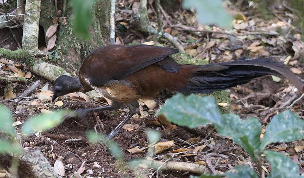
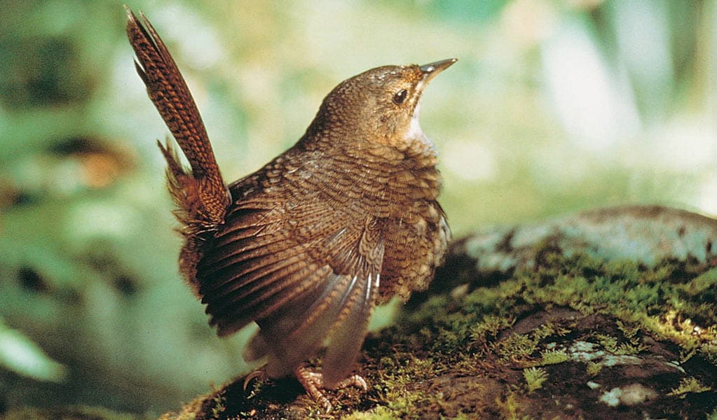
Albert's lyrebird (Menura alberti)
The Albert’s lyrebird is much rarer than the superb lyrebird. Distinguished by its richer brown plumage and less elaborate tail feathers, it’s protected as a threatened species in NSW.
-
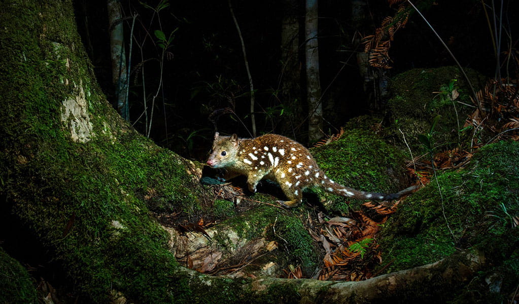
Spotted-tailed quoll (Dasyurus maculatus)
The spotted-tailed quoll is the largest remaining carnivorous marsupial on the Australian mainland. It’s protected as a vulnerable species in NSW.
-
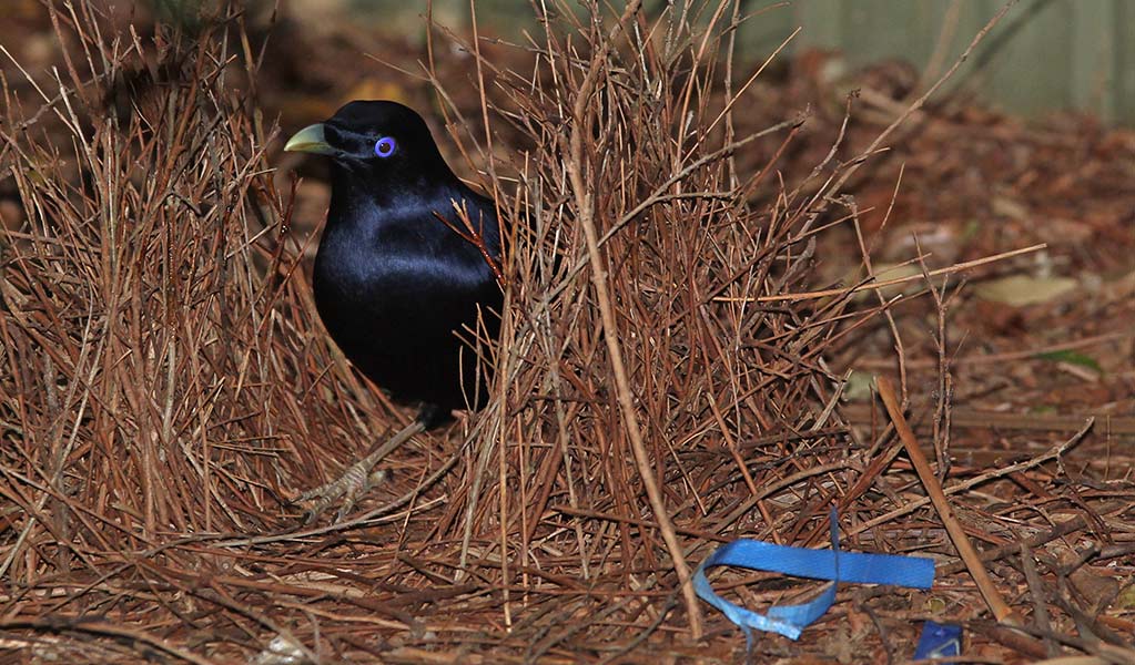
Satin bowerbird (Ptilonorhynchus violaceus)
With vibrant blue-violet eyes and curious antics, the satin bowerbird is a favourite for bird watching and easy to spot as it forages for food in open forest. Relatively common across eastern Australia, in NSW they’re found in coastal rainforests and adjacent woodlands and mountain ranges.
-
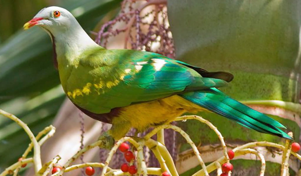
Wompoo fruit-dove (Ptilinopus magnificus)
The wompoo fruit-dove is a marvellously multi-coloured pigeon that makes its home in rainforest along coastal ranges from mid-north NSW to southern Queensland. It’s protected as a vulnerable species in NSW.
-
Rufous scrub-bird (Atrichornis rufescens)
The vulnerable rufous scrub-bird is a small, ground-foraging bird that lives only in isolated rainforest areas of south-eastern Australia.
-
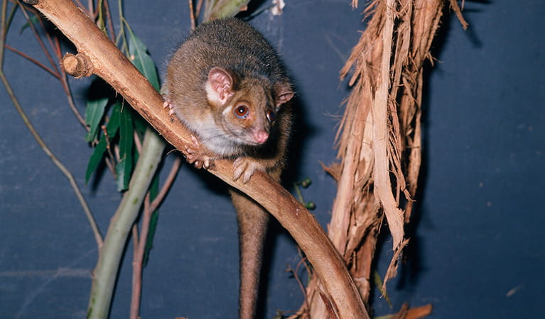
Common ringtail possum (Pseudocheirus peregrinus)
Commonly found in forests, woodlands and leafy gardens across eastern NSW, the Australian ringtail possum is a tree-dwelling marsupial. With a powerful tail perfectly adapted to grasp objects, it forages in trees for eucalypt leaves, flowers and fruit.
-
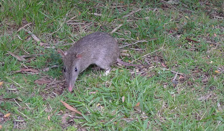
Long-nosed bandicoot (Perameles nasuta)
A nocturnal marsupial and one of the smaller Australian native animals, the long-nosed bandicoot is found across eastern Australia. Populations in the Sydney region have dwindled since European settlement, leaving only endangered colonies in inner western Sydney and at North Head, near Manly. The long-nosed bandicoot has grey-brown fur and a pointed snout which it uses to forage for worms and insects.
-
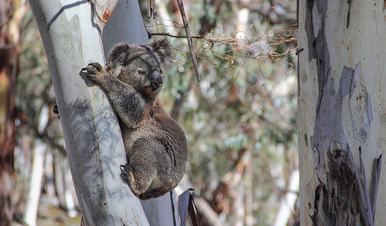
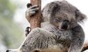
Koala (Phascolarctos cinereus)
One of the most renowned Australian animals, the tree-dwelling marsupial koala can be found in gum tree forests and woodlands across eastern NSW, Victoria and Queensland, as well as in isolated regions in South Australia. With a vice-like grip, this perhaps most iconic but endangered Australian animal lives in tall eucalypts within a home range of several hectares.
-
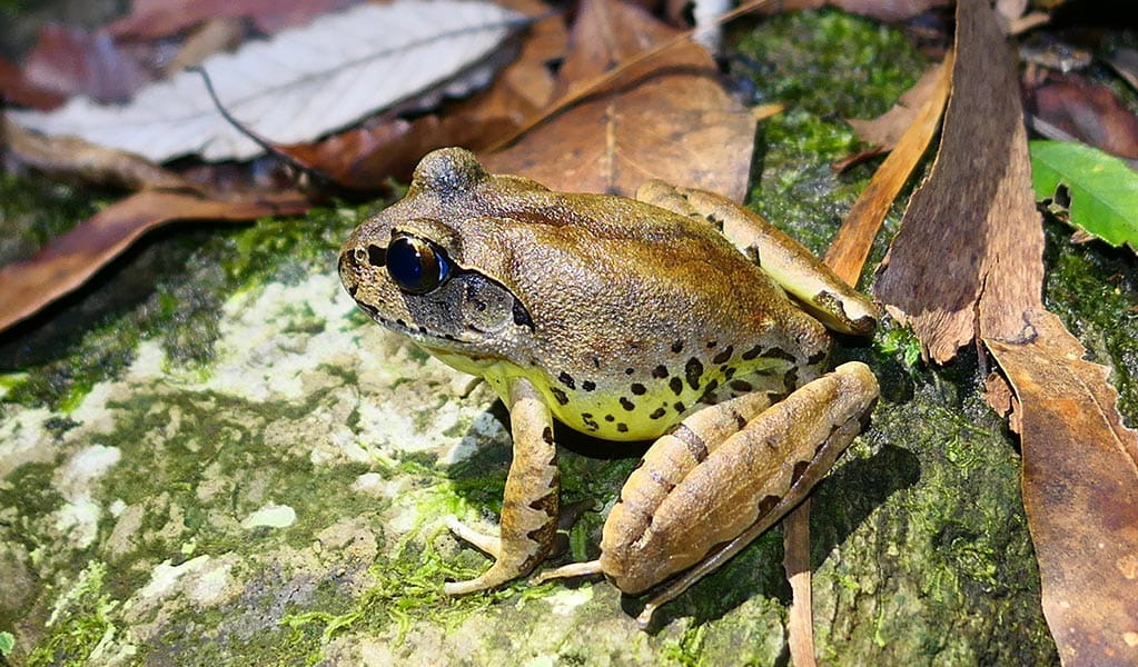
Fleay's barred frog (Mixophyes fleayi)
The Fleay’s barred frog is an endangered species restricted to rainforest stream habitats in north-east NSW and south-east Queensland.
-
Eastern bristlebird (Dasyornis brachypterus)
The endangered eastern bristlebird is a shy, ground-dwelling songbird. Less than 2,500 birds are left in the wild, restricted to 3 isolated areas in eastern NSW and southern Queensland.
Plants
-
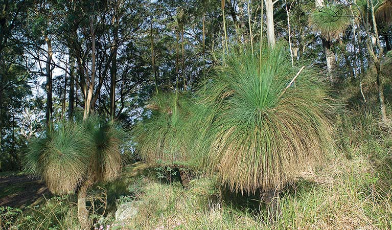
Grass tree (Xanthorrea spp.)
An iconic part of the Australian landscape, the grass tree is widespread across eastern NSW. These Australian native plants have a thick fire-blackened trunk and long spiked leaves. They are found in heath and open forests across eastern NSW. The grass tree grows 1-5m in height and produces striking white-flowered spikes which grow up to 1m long.