Belougery Split Rock walking track
Warrumbungle National Park
Overview

Best approached by experienced bushwalkers and visitors with moderate fitness, Belougery Split Rock walking track leads to stunning views and some terrific birdwatching.
- Where
- Warrumbungle National Park in Country NSW
- Distance
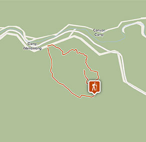
- 4.6km loop
- Time suggested
- 2hrs 30min - 3hrs 30min
- Grade
- Grade 4
- Entry fees
- Park entry fees apply
- Please note
- If you’re bushwalking, it’s a good idea to bring a topographic map and compass, or a GPS.
- This walk is suitable for experienced bushwalkers who are comfortable undertaking self-reliant hiking
- There is limited/no mobile reception in this park
- It’s a good idea to put sunscreen on before you set out and remember to take a hat and drinking water
- Remember to take your binoculars if you want to go birdwatching
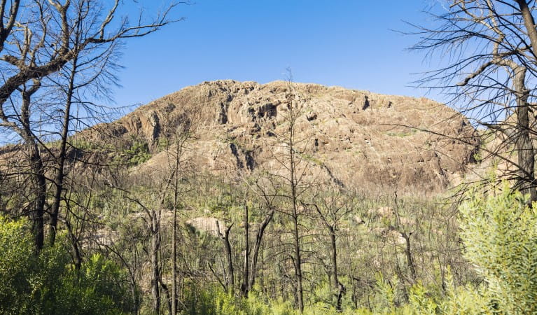
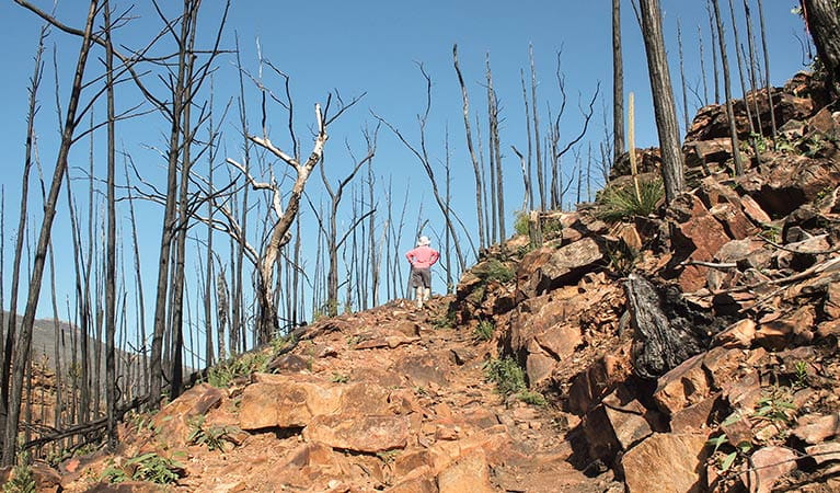
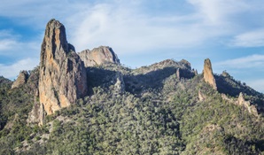
One for experienced bushwalkers and the older kids, Belougery Split Rock walking track is a moderate challenge with a big reward at the end. Climbing up and around one of Warrumbungle National Park’s most distinctive peaks, an ancient lava dome, the rough path threads around many obstacles along the way. The final stretch to the summit, for example, involves a scramble up steps carved into the side of a rocky knoll. Be sure to bring plenty of water.
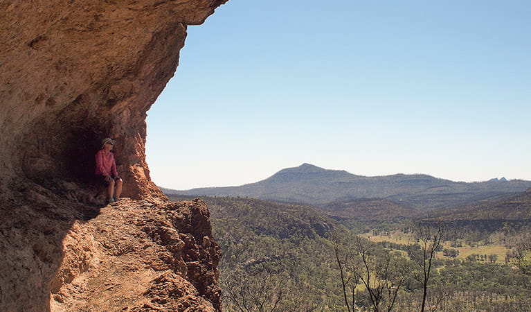
Nevertheless, once you reach the top of Split Rock, all thoughts of exertion fall away. The 360-degree views are spectacular here, showing off Warrumbungle mountain and the seemingly infinite Western Plains stretching off into the distance over an ancient volcanic landscape.
Pack a camera, and maybe a small picnic, so you can settle down and soak up the ambience. You might like to carry some binoculars too, as wedge-tailed eagles live in the area, making this a popular haunt for birdwatching. If you’re lucky, you may even spot a shy red-necked wallaby or wallaroo, lazing in the many wildflowers during spring.
Take a virtual tour of Belougery Split Rock walking track captured with Google Street View Trekker.
Google Street View Trekker
Using Google Street View Trekker, we've captured imagery across a range of NSW national parks and attractions. Get a bird's eye view of these incredible landscapes before setting off on your own adventure.

Download the NSW GeoTours app
Go on an interactive adventure in Warrumbungle National Park with the free NSW GeoTours app on your smartphone or tablet. Explore geotrails, investigate the eroded remnants of a volcano and learn the park’s explosive history.
General enquiries
- National Parks Contact Centre
- 7am to 7pm daily
- 1300 072 757 (13000 PARKS) for the cost of a local call within Australia excluding mobiles
- parks.info@environment.nsw.gov.au
Operated by
- Warrumbungle NP Visitor Information Centre
- 9am to 4pm daily. Closed Christmas Day.
- 02 6825 4364
- warrumbungle.np@environment.nsw.gov.au
- 4261 John Renshaw Parkway, Warrumbungle NSW 2828
Park info
- in Warrumbungle National Park in the Country NSW region
Warrumbungle National Park is always open but may have to close at times due to poor weather or fire danger.
-
Park entry fees:
$8 per vehicle per day.
Buy annual pass
What's nearby:
Things to do (25)
- Aboriginal culture (1)
- Adventure sports (1)
- Birdwatching and wildlife encounters (8)
- Cultural heritage (1)
- Educational activities (1)
- Historic heritage (1)
- Other experiences (1)
- Picnics and barbecues (3)
- Road trips and car/bus tours (2)
- Sightseeing (17)
- Swimming (1)
- Visitor centres (1)
- Walking (18)
- Wildflowers (seasonal) (10)