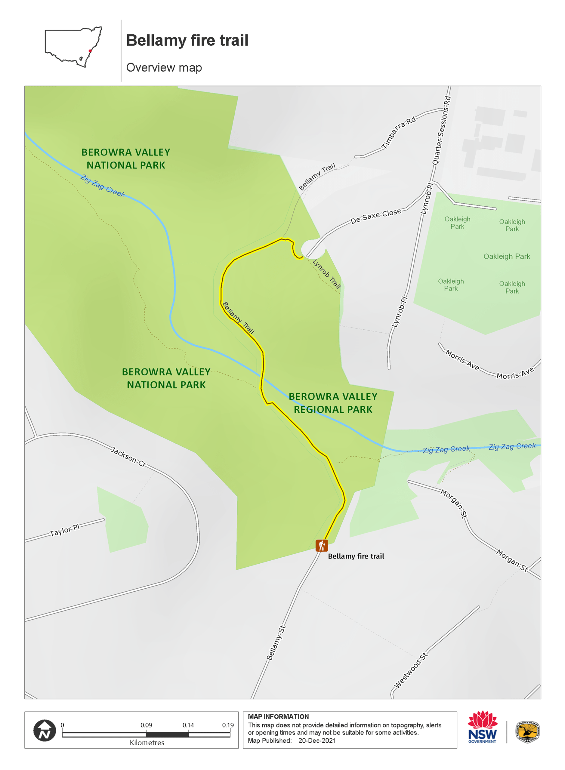
Bellamy fire trail
Berowra Valley Regional Park
Overview
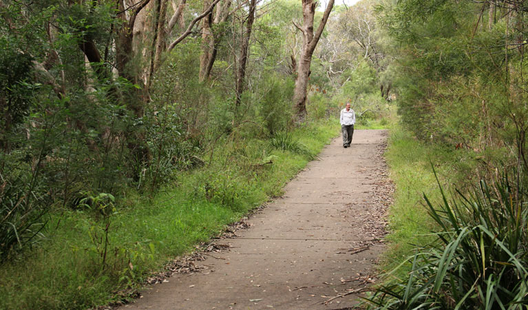
Bellamy fire trail is a northern Sydney secret. This short walk through Berowra Valley Regional Park connects Pennant Hills and Thornleigh along a dog-friendly bushland trail.
- Accessibility
- Medium
- Distance
- 0.6km one-way
- Time suggested
- 30 - 45min
- Grade
- Grade 3
- Opening times
The Bellamy fire trail is open from sunrise to sunset and may be closed at times due to poor weather or fire danger.
- What to
bring - Sunscreen, hat, drinking water
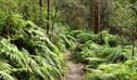
This short walk through Berowra Valley Regional Park is perfect for a city breather. Berowra Valley Regional Park is right next door to Berowra Valley National Park. A level path takes you down to Zig-Zag Creek, over a bridge and up to the high walls and towering forest of the old railway quarry, an attractive natural amphitheatre of sandstone.
You’ll see fern trees, grass trees, coachwood and a variety of tall eucalypts while hearing the joyful call of kookaburras. Interpretive signs tell the history of the historic Zig-Zag railway that used to pass through here. Take a seat on the old railway sleepers and enjoy the peace and beauty of the bush before returning the way you came.
Also see
-
Great North walk - Berowra Valley National Park
Also known as Benowie walking track, this section of the iconic Great North walk between Sydney and Newcastle makes a great overnight hike or day walk. Camp out the night for an unforgettable bushland adventure.
Map
Map legend

Local alerts
For the latest updates on fires, closures and other alerts in this area, see https://www.nationalparks.nsw.gov.au/things-to-do/walking-tracks/bellamy-fire-trail/local-alerts
General enquiries
- National Parks Contact Centre
- 7am to 7pm daily
- 1300 072 757 (13000 PARKS) for the cost of a local call within Australia excluding mobiles
- parks.info@environment.nsw.gov.au
Park info
- in Berowra Valley Regional Park in the Sydney and surrounds region
Visitor info
All the practical information you need to know about Bellamy fire trail.
Track grading
Features of this track
Distance
0.6km one-way
Time
30 - 45min
Quality of markings
Sign posted
Experience required
No experience required
Gradient
Short steep hills
Steps
Occasional steps
Quality of path
Well-formed track
Getting there and parking
Get driving directions
Bellamy fire trail is in the regional park precinct of Berowra Valley National Park. To get there:
- From the M2 motorway, take the Pennant Hills Road exit and head north.
- Turn left at Observatory Park to stay on Pennant Hills Road
- Turn left onto Boundary Road in Pennant Hills
- Turn right onto Bellamy Street and follow all the way to the end of the road, where the track begins.
From Thornleigh:
- You can join Bellamy fire trail from De Saxe Close, which leads off the intersection of Quarter Sessions Road and Giblett Avenue, Thornleigh.
Parking
Parking is available for the Bellamy fire trail at the end of Bellamy Street, Pennant Hills, and on De Saxe Close, Thornleigh.
Best times to visit
There are lots of great things waiting for you in Berowra Valley National Park. Here are some of the highlights.
Spring
Enjoy the spring wildflowers and take on the challenge of the Great North walk before the weather gets too warm
Summer
Swim in Berowra creek in the warmer months - remember safety precautions around waterways
Winter
Winter is generally great for bushwalking in the Sydney region but bring warm gear if you're camping - nights can be cold in the bush
Weather, temperature and rainfall
Summer temperature
Average
18°C and 28°C
Highest recorded
43.1°C
Winter temperature
Average
6°C and 18°C
Lowest recorded
-3.5°C
Rainfall
Wettest month
March
Driest month
July
The area’s highest recorded rainfall in one day
253mm
Maps and downloads
Accessibility
Disability access level - medium
- The walking track follows a concrete path through bushland, between Bellamy Street, Pennant Hills and De Saxe Close, Thornleigh.
- The path is suitable for wheelchairs, prams, and visitors with limited mobility, for the first 300m. From here, there's a short steep hill after the bridge crossing Zig Zag Creek, which requires assistance. There's a handrail on 1 side of the hill.
- Assistance may be required to pass through the bollards at either end of this walking track.
- There's a picnic table near the Bellamy Street end of the walk and low, log seating in the amphitheatre, around half way.
Medium access presents some minor difficulties, such as a grassy surface. You may require a little assistance to get around in some areas.
Permitted
Pets
You can walk your dog on-lead at this location. See other regional parks in NSW that have dog walking areas.
Dog walking is permitted on Bellamy fire trail as it traverses the adjacent park, Berowra Valley Regional Park. Dogs need to be kept on a leash at all times, and please remember to pick up after them.
Dog walking is not permitted on Benowie walking track or Jungo walk.
Prohibited
Smoking
NSW national parks are no smoking areas.