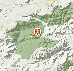
Tommys Rock lookout and walking track
Mann River Nature Reserve
Visitor info
All the practical information you need to know about Tommys Rock lookout and walking track.
Track grading
Features of this track
Distance
8km return
Time
3hrs 30min - 4hrs 30min
Quality of markings
No directional signage
Experience required
Some bushwalking experience recommended
Gradient
Short steep hills
Steps
No steps
Quality of path
Formed track, some obstacles
Getting there and parking
Get driving directions
Tommys Rock lookout and walking track is in Mann River Nature Reserve. To get there:
- Drive west of Grafton along Gwydir Highway for 125km or east from Glen Innes for 37km
- Take the unsealed Old Grafton Road and drive for approximately 2km before descending 14km on sealed road to the base of Big Hill
- Driving past Mann River campground continue along Old Grafton Road for about 6km
- Park at the bottom of the track if you intend to take the steep 9km round trip, alternatively drive 4.5km to the lookout carpark.
Road quality
Check the weather before you set out as the road to Tommys Rock lookout can become boggy when it rains.
Parking
Parking is available at Tommy’s lookout carpark or along the road near the start of the walking track.
Best times to visit
There are lots of great things waiting for you in Mann River Nature Reserve. Here are some of the highlights.
Autumn
A great time for bushwalking, birdwatching and photography.
Spring
A great time for birdwatching and bushwalking.
Summer
Enjoy fishing and swimming the majestic Mann River.
Winter
Winter is best for crisp, clear skies and excellent stargazing.
Weather, temperature and rainfall
Summer temperature
Average
12°C and 25°C
Highest recorded
34.5°C
Winter temperature
Average
0.7°C and 14°C
Lowest recorded
-8.3°C
Rainfall
Wettest month
December
Driest month
April
The area’s highest recorded rainfall in one day
140mm
Facilities
- Drinking water is limited or not available in this area, so it’s a good idea to bring your own.
- You’re encouraged to bring gas or fuel stoves, especially in summer during the fire season.
Maps and downloads
Prohibited
Pets
Pets and domestic animals (other than certified assistance animals) are not permitted. Find out which regional parks allow dog walking and see the pets in parks policy for more information.
Smoking
NSW national parks are no smoking areas.
Operated by
- Glen Innes office
- Monday to Friday, 8.30am to 4.30pm.
- 02 6739 0700
- npws.ntab@environment.nsw.gov.au
- 68 Church Street, Glen Innes NSW 2370
Park info
- in Mann River Nature Reserve in the Country NSW region
Mann River Nature Reserve is always open but may have to close at times due to poor weather or fire danger.