Brindle Creek picnic area
Border Ranges National Park
Visitor info
All the practical information you need to know about the Brindle Creek picnic area.
Getting there and parking
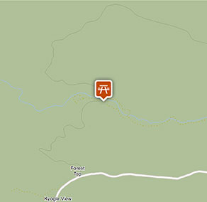
Brindle Creek picnic area is in the Sheepstation Creek precinct of Border Ranges National Park. To get there:
- From Lismore, head north-west and follow signs to Kyogle for approximately 40km.
- From Kyogle, follow Murwillumbah Road for 30km north to Barkers Vale.
- Enter the eastern precinct of the park along the Tweed Range Scenic Drive
- Follow the signs to Forest Tops campground and take the Brindle Creek turnoff. It's about 2km to the picnic area.
Road quality
The road to Brindle Creek picnic area is a well-maintained gravel road; however, following heavy rains between December to May, the surface can be rough or slippery in parts.
- Unsealed roads
Vehicle access
- 2WD vehicles
Weather restrictions
- 4WD required in wet weather
Parking
Parking is available at on unsealed, gravel Brindle Creek Road at Brindle Creek picnic area.
Best times to visit
There are lots of great things waiting for you in Border Ranges National Park. Here are some of the highlights.
Autumn
A picnic at Border Loop lookout and picnic area is a must during autumn. It's also a popular spot to see the historic Border Loop railway line.
Spring
The perfect time to get away from it all on a family camping trip. Sheepstation Creek campground is a great base for exploring Border Ranges National Park.
Summer
Watching the sunrise from Pinnacle lookout offers the best views of the crater escarpment, Wollumbin-Mount Warning and the coast. You're bound to find it a breathtaking experience.
Winter
Take in the park's scenery from the comfort of your car or motor home as you drive along the Tweed Range Scenic drive. Be sure to take some breaks along the way though – you don't want to miss the views.
Weather, temperature and rainfall
Summer temperature
Average
18°C and 30°C
Highest recorded
42.9°C
Winter temperature
Average
8°C and 22°C
Lowest recorded
-0.3°C
Rainfall
Wettest month
February
Driest month
September
The area’s highest recorded rainfall in one day
321mm
Facilities
Rubbish bins are not provided at Brindle Creek picnic area, please take your rubbish with you
Toilets
There are accessible non-flush toilets north of the creek, in the northern part of the picnic area. There's a raised walkway with handrails that leads to the entrance.
- Non-flush toilets
Picnic tables
Maps and downloads
Accessibility
Disability access level - medium
Brindle Creek picnic area is mostly flat, but there are some areas where people with reduced mobility may need assistance:
- There are no pathways. From the carpark, you'll need to cross over hard-packed ground to reach the facilities.
- The ground may be uneven and there are some steps leading to the picnic tables
There are accessible toilets in the northern part of the picnic area, north of the creek. There's a raised walkway with handrails that leads to the entrance.
Prohibited
Pets
Pets and domestic animals (other than certified assistance animals) are not permitted. Find out which regional parks allow dog walking and see the pets in parks policy for more information.
Smoking
NSW national parks are no smoking areas.
Operated by
- Kyogle office
- Monday to Friday, 8.30am to 4.30pm.
- 02 6632 0000
- npws.richmondriver@environment.nsw.gov.au
- 136 Summerland Way, Kyogle NSW 2474
Park info
- in Border Ranges National Park in the North Coast region
Border Ranges National Park is always open but may have to close at times due to poor weather or fire danger.
-
Park entry fees:
$8 per vehicle per day.
Buy annual pass