Wentworth Falls to McMahons Point
Katoomba area in Blue Mountains National Park
Overview
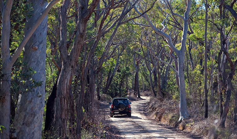
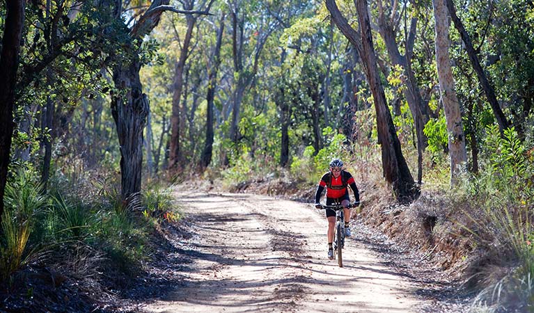
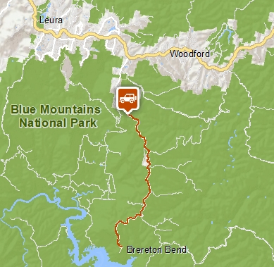
This unsealed 4WD and cycle trail follows Kings Tableland Road from Wentworth Falls to scenic McMahons Point lookout. Enjoy sweeping views of Lake Burragorang and the Greater Blue Mountains wilderness.
- Distance
- 42km return
- Grade
- Medium
- What to
bring - Drinking water, hat, sunscreen, bike repair kit, helmet
- Please note
- Drivers please watch out for cyclists.
- The trail is a medium difficulty 8-9hr return bike ride from the old hospital, with undulating hills and several long climbs.
- This is a remote area of Blue Mountains National Park. Please ensure you're well-prepared.
- Check the weather and road conditions before you set out. Weather can be unpredictable and the track can be boggy and potholed after rain.
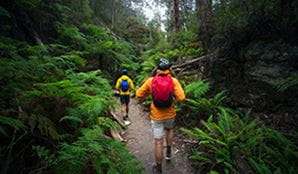
Head off the beaten track along this remote 4WD trail in southern Wentworth Falls. You’ll discover unspoilt views across Lake Burragorang and the Blue Mountains wilderness beyond, from 2 lookouts at McMahons Point. Intrepid mountain bikers looking for a challenge can also cycle this medium difficulty trail.
Several kilometres beyond the Great Western Highway turnoff, the sealed road and suburbs give way to expansive bushland with scenic glimpses of Jamison Valley. Passing the Old Queen Victoria Hospital, you’ll join the gravel Kings Tableland Road which winds 21km through forest and heath to McMahons Point.
Stop off at heritage-listed Kings Tableland Aboriginal Place on the way, to learn about this area’s Aboriginal significance.
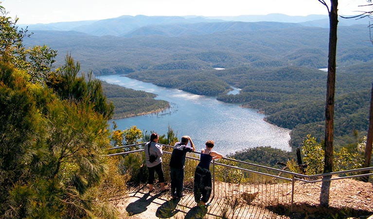
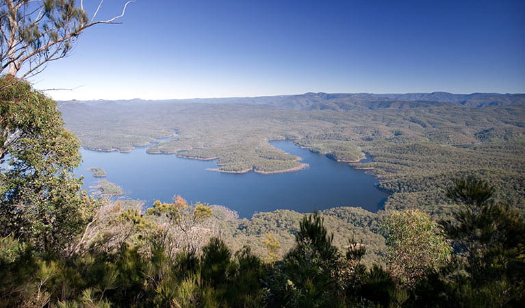
Arriving at McMahons Point, which marks the end of the road, you can stretch your legs on the 800m walk to McMahons Point lookout. At 500m above Lake Burragorang, you’re rewarded with impressive views across the massive reservoir that supplies most of Sydney’s water.
A second lookout can be accessed along a 200m track past the picnic tables, near the carpark. Take advantage of the picnic area and fresh air, enjoy a hearty picnic lunch at the tables provided and drink in the scenic wilderness views.
Take a virtual tour of McMahon's Point ride - Wentworth Falls captured with Google Street View Trekker.
Google Street View Trekker
Using Google Street View Trekker, we've captured imagery across a range of NSW national parks and attractions. Get a bird's eye view of these incredible landscapes before setting off on your own adventure.

Think Before You TREK
Are you planning a bushwalk, going somewhere remote or where the weather is extreme? Stay safe by planning your trip for all conditions and telling someone about it.
Operated by
- Blue Mountains Heritage Centre and Blackheath office
- 9am to 4.30pm daily. Closed Christmas Day.
- 02 4787 8877
- bluemountains.heritagecentre@environment.nsw.gov.au
- 270 Govetts Leap Road, Blackheath NSW 2785
Park info
- in the Katoomba area of Blue Mountains National Park in the Sydney and surrounds region
Katoomba area is always open but some locations may close at times due to maintenance, poor weather or fire danger.
What's nearby:
Things to do (101)
- 4WD touring (3)
- Aboriginal culture (7)
- Adventure sports (6)
- Birdwatching and wildlife encounters (10)
- Cafes and kiosks (2)
- Cycling (9)
- Environmental appreciation/study (2)
- Historic heritage (8)
- Other experiences (7)
- Photography (3)
- Picnics and barbecues (6)
- Road trips and car/bus tours (3)
- Sightseeing (52)
- Swimming (3)
- Walking (54)
- Waterfalls (33)
- Wildflowers (seasonal) (1)