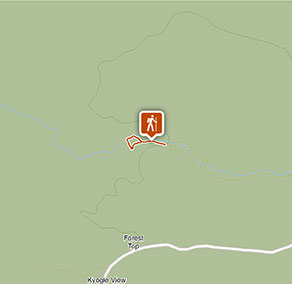
Red Cedar loop
Border Ranges National Park
Visitor info
All the practical information you need to know about Red Cedar loop.
Track grading
Features of this track
Distance
0.75km loop
Time
20 - 40min
Quality of markings
Clearly sign posted
Experience required
No experience required
Gradient
Flat
Quality of path
Formed track: The walk is 1m-wide and hard-packed ground along its length, with a short section that's a fibre-reinforced polymer mesh walkway.
Steps
Occasional steps: Part of the walk is a raised walkway, built to protect important frog habitat. There's a step onto and off this walkway.
Other barriers
Pinch points: There may be points where the track narrows due to tree roots, rocks and vegetation.
Other barriers: There are points along the walk where you'll need to step over or around buttress tree roots on the track.
Getting there and parking
Red Cedar loop is in the eastern precinct of Border Ranges National Park. To get there:
- Travel north from Kyogle along Summerland Way for 14km until you reach Wiangaree
- At Wiangaree turn right onto Lynches Creek Road and travel east for 12km to Forest Road
- Turn right onto Forest Road and continue 4.5km to Border Ranges park boundary
- Continue on Tweed Range Scenic Drive for 6.5km to Brindle Road, which is clearly signposted on the left.
- Travel nearly 2km along Brindle Creek Road to Brindle Creek carpark
Buses (no more than 22 passengers) and trailers over 7m are not permitted on Tweed Range Scenic Drive.
Vehicle access
- 2WD vehicles
Weather restrictions
- 4WD required in wet weather
Parking
Parking is available in a gravel carpark at Brindle Creek where the walk begins.
Best times to visit
There are lots of great things waiting for you in Border Ranges National Park. Here are some of the highlights.
Autumn
A picnic at Border Loop lookout and picnic area is a must during autumn. It's also a popular spot to see the historic Border Loop railway line.
Spring
The perfect time to get away from it all on a family camping trip. Sheepstation Creek campground is a great base for exploring Border Ranges National Park.
Summer
Watching the sunrise from Pinnacle lookout offers the best views of the crater escarpment, Wollumbin-Mount Warning and the coast. You're bound to find it a breathtaking experience.
Winter
Take in the park's scenery from the comfort of your car or motor home as you drive along the Tweed Range Scenic drive. Be sure to take some breaks along the way though – you don't want to miss the views.
Weather, temperature and rainfall
Summer temperature
Average
18°C and 30°C
Highest recorded
42.9°C
Winter temperature
Average
8°C and 22°C
Lowest recorded
-0.3°C
Rainfall
Wettest month
February
Driest month
September
The area’s highest recorded rainfall in one day
321mm
Facilities
- Accessible toilets are located at Brindle Creek picnic area, where this walk starts.
- Drinking water is not available in this area, so it’s a good idea to bring your own.
- You’re encouraged to bring gas or fuel stoves, especially in summer during the fire season.
Maps and downloads
Accessibility
Disability access level - medium
Red Cedar loop is a 1m-wide hard-packed ground track that's flat and mostly step-free.
There are some sections of the walk where people with reduced mobility may need assistance:
- Part of the track becomes a raised fibre-reinforced polymer mesh walkway. There's a step from the main track onto and off this walkway.
- There are points along the walk where you'll need to step over or around buttress tree roots that protrude onto the track.
- There are also sections where the track narrows due to rocks and vegetation
- The carpark is hard-packed gravel
There's an accessible toilet at Brindle Creek picnic area, where this walk begins. It has a 1.2m-wide elevated walkway leading up to the entrance.
Prohibited
Pets
Pets and domestic animals (other than certified assistance animals) are not permitted. Find out which regional parks allow dog walking and see the pets in parks policy for more information.
Smoking
NSW national parks are no smoking areas.
Park info
- in Border Ranges National Park in the North Coast region
Border Ranges National Park is always open but may have to close at times due to poor weather or fire danger.
-
Park entry fees:
$8 per vehicle per day.
Buy annual pass