Boyds Tower to Saltwater Creek walking track
Green Cape area in Beowa National Park
Overview
Upgrades to Light to Light Walk
Upgrades to Light to Light walking track are underway and should be completed by mid 2024. Check for current and upcoming closures here. The date has been impacted by ongoing wet weather and additional track improvements. Find out more about the investment being made to upgrade Light to Light Walk in Beowa National Park.
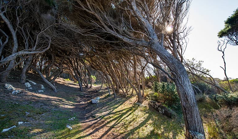
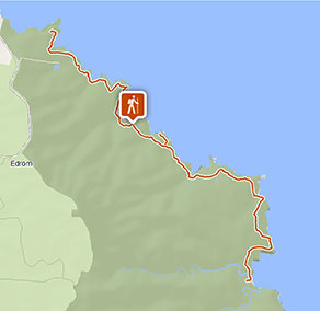
A section of the 30km Light to Light walk, Boyds Tower to Saltwater Creek walk covers 13.2km through scenic coast forest, with opportunities for swimming, fishing and birdwatching.
- Where
- Green Cape area in Beowa National Park in South Coast
- Distance
- 13.2km one-way
- Time suggested
- 4hrs 30min - 5hrs 30min
- Grade
- Grade 4
- Trip Intention Form
-
It's a good idea to let someone know where you're going. Fill in a trip intention form to send important details about your trip to your emergency contact.
- Entry fees
- Park entry fees apply
- What to
bring - Drinking water, hat, sunscreen
- Please note
- Remember to take your binoculars if you want to go birdwatching or whale watching
- Firewood is not supplied
- If you’re bushwalking in this park, it’s a good idea to bring a topographic map and compass, or a GPS.
- A current NSW recreational fishing licence is required when fishing in all waters. Please note that netting and spear fishing are not permitted in the park, and you’re not allowed to collect crustaceans and marine animals from the rocks.
- Be sure to download the Light to Light walk app for iPhone or Android before you set out. The app offers plenty of information about the area’s Aboriginal heritage, plants and animals. You can also download an audio tour and listen to the appropriate sections between Boyds Tower and Saltwater Creek.
- There is limited/no mobile reception in this park.
For an enticing sample of Light to Light walk, consider tracing a smaller section of its 30km, from Boyds Tower to Saltwater Creek walking track.
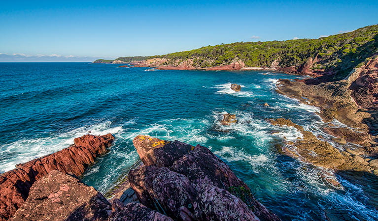
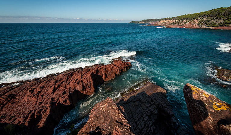
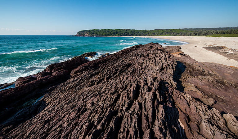
This invigorating walk undulates south past spectacular coastal forest, sandy beaches, rocky bays, sheltered inlets and ocean platforms. Leather Jacket Bay offers a scenic stretch of red rocks, coloured by iron oxide which cemented the sand particles together some 320 million years ago. And, if you’re after somewhere small and peaceful, Mowarry provides a picturesque sandy beach where you can go fishing or swimming.
There’s plenty of spots along the way to stop for picnics, swimming, fishing, or birdwatching. Flowers bloom in the woollybutt forest during spring. Whales frequent the area from late May to early December, making it a great time for whale watching.
Choose to stay overnight at the remote campsite near Mowarry Point or the popular Saltwater Creek campground. To enhance your visit further, check out the smartphone apps for iPhone or Android to access available audio tours.
Take a virtual tour of Boyds Tower to Saltwater Creek walking track captured with Google Street View Trekker.
Google Street View Trekker
Using Google Street View Trekker, we've captured imagery across a range of NSW national parks and attractions. Get a bird's eye view of these incredible landscapes before setting off on your own adventure.

General enquiries
- National Parks Contact Centre
- 7am to 7pm daily
- 1300 072 757 (13000 PARKS) for the cost of a local call within Australia excluding mobiles
- parks.info@environment.nsw.gov.au
Operated by
- Merimbula office
- Monday to Friday and some weekends during peak holiday periods, 10am to 3pm.
- 02 6495 5000
- npws.sapphirecoast@environment.nsw.gov.au
- 47 Merimbula Drive, cnr Sapphire Coast Drive, Merimbula NSW 2548
Park info
- in the Green Cape area of Beowa National Park in the South Coast region
The Green Cape area of Beowa National Park is always open but may have to close at times due to poor weather or fire danger.
-
$8 per vehicle per day in the Green Cape area of the park (south of Eden).
Buy annual pass