4WD Oberon Colong historic stock route
Southern Blue Mountains area in Blue Mountains National Park
Overview
Intrepid 4WD tourers will love the 4WD Oberon Colong historic route. Travel through the wild south of Blue Mountains National Park to a historic mining ghost town in Yerranderie Regional Park.
- Where
- Southern Blue Mountains area in Blue Mountains National Park in Sydney and surrounds, Country NSW
- Accessibility
- No wheelchair access
- Distance
- 63km one-way
- Time suggested
- 2hrs
- Grade
- Medium
- What to
bring - Drinking water, snacks
- Please note
- No fuel, water or food is available along this route, so please be well-prepared.
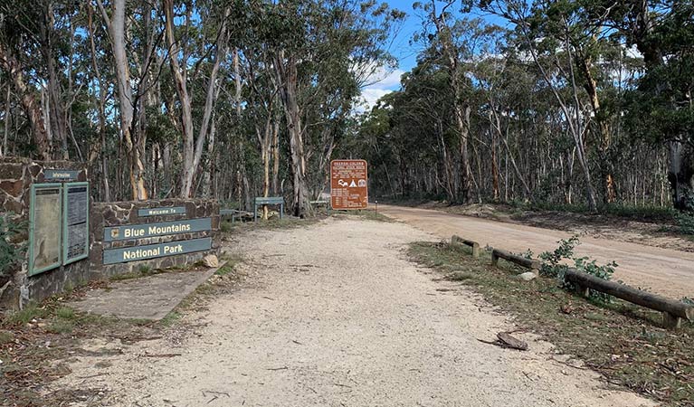
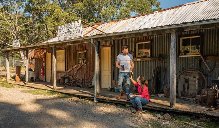
The 4WD Oberon Colong historic route (Mount Werong Road) is an adventurous drive through the remote Southern Blue Mountains area, near Oberon. The unsealed trail takes you deep into the wilderness of Blue Mountains National Park, to reach a forgotten ghost town in Yerranderie Regional Park.
The route follows slopes that plunge down to Wollondilly River to the south and Kowmung River to the north, offering tantalising glimpses of the rugged Kanangra-Boyd wilderness. Stop at Mount Werong campground along the way, and stretch your legs on a walk to historic Ruby Creek mine. Continue on your spectacular drive, dipping and weaving along the crest of the Murruin Range to Yerranderie Private Town, a carefully preserved silver mining town where you can stay overnight.
Keep your eyes peeled for kangaroos, wallabies, wombats and maybe even a shy echidna as you make your way along the route. If you’re a keen birdwatcher, be sure to look out for the gorgeous forest flocks of rainbow lorikeets and sulphur-crested cockatoos in spring and summer. At night, you might hear the cries of the powerful and sooty owls.
Take a virtual tour of 4WD Oberon Colong historic stock route captured with Google Street View Trekker.
Nearby
-
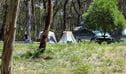
Mount Werong campground
Mount Werong campground is a great base to explore the mountain bike trails, bushwalks, and historic heritage in the remote south of Blue Mountains National Park, near Oberon.
-
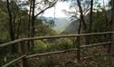
Ruby Creek walking track
Ruby Creek walking track is an easy return walk from Mount Werong campground. It offers mining heritage and waterfall views in the remote Southern Blue Mountains area, near Oberon.
Map

Map legend

Local alerts
For the latest updates on fires, closures and other alerts in this area, see https://www.nationalparks.nsw.gov.au/things-to-do/4wd-touring-routes/4wd-oberon-colong-historic-stock-route/local-alerts
Park info
- in the Southern Blue Mountains area of Blue Mountains National Park in the Sydney and surrounds and Country NSW regions
Southern Blue Mountains area is always open but some locations may close at times due to poor weather or fire danger.
Visitor info
All the practical information you need to know about 4WD Oberon Colong historic stock route.
Getting there and parking
Get driving directions
4WD Oberon Colong historic stock route is in the Southern Blue Mountains area of Blue Mountains National Park, bordered by Kanangra-Boyd National Park. To get there:
- Start at Oberon on Edith Road, then turn right after 8km onto Butter Factory Lane, which leads onto Shooters Hill Road.
- Turn left onto Mount Werong Road (also known as Colong Oberon historic stock route) and follow this unsealed road past Mount Werong campground.
- Continue all the way along the crest of Murruin Range to Yerranderie Regional Park.
Road access, conditions and restrictions
- Restricted access: There’s no direct access to Southern Blue Mountains area or Yerranderie through the Burragorang Valley from East Picton or Oakdale. This is a Schedule 1 protected water catchment with access restrictions. If you’re using GPS or online mapping, please enter Oberon or Goulburn as your destination to avoid navigational issues.
- In wet weather, check alerts for conditions or closures.
- Watch for kangaroos, wombats and fallen trees on the Oberon Colong stock route. Keep speed down to avoid accidents and punctures.
- Unsealed Road. AWD/4WD recommended.
- Unsealed roads
Maps and downloads
Accessibility
Disability access level - no wheelchair access
Prohibited
Pets
Pets and domestic animals (other than certified assistance animals) are not permitted. Find out which regional parks allow dog walking and see the pets in parks policy for more information.
If you're travelling through a national park or reserve on a public road you can have pets inside your vehicle. However, you must keep them inside your vehicle while driving through national parks or reserves. You must also comply with any conditions in the park’s plan of management, and you cannot stop to visit the park or use park facilities (unless for safety reasons, or to use publicly accessible toilets).
Smoking
NSW national parks are no smoking areas.
Learn more
4WD Oberon Colong historic stock route is in Southern Blue Mountains area. Here are just some of the reasons why this park is special:
A sanctuary for plants and animals
The remote Southern Blue Mountains area provides a sanctuary for many animals and plants. Threatened species take refuge here, including the stuttering frog which you may hear around Mount Werong. The tall, old growth forests provide hollows for powerful owls, greater gliders and vulnerable yellow bellied gliders. The extensive limestone cave system is a favourite haunt of the sooty owl, while spotted-tailed quolls den in fallen logs, small caves, or rock outcrops.
A window into the past
The Oberon-Colong stock route, which follows Mount Werong Road, forms part of an old route farmers ran their cattle and sheep from Oberon to the Burragorang Valley. Along the route you can also see evidence of the area’s mining history. Enjoy the scenic walk to Ruby Creek Mine from Mount Werong campground, or tour the silver mining ghost town at Yerranderie.
- 4WD Oberon Colong historic stock route Intrepid 4WD tourers will love the 4WD Oberon Colong historic route. Travel through the wild south of Blue Mountains National Park to a historic mining ghost town in Yerranderie Regional Park.
Action adventure
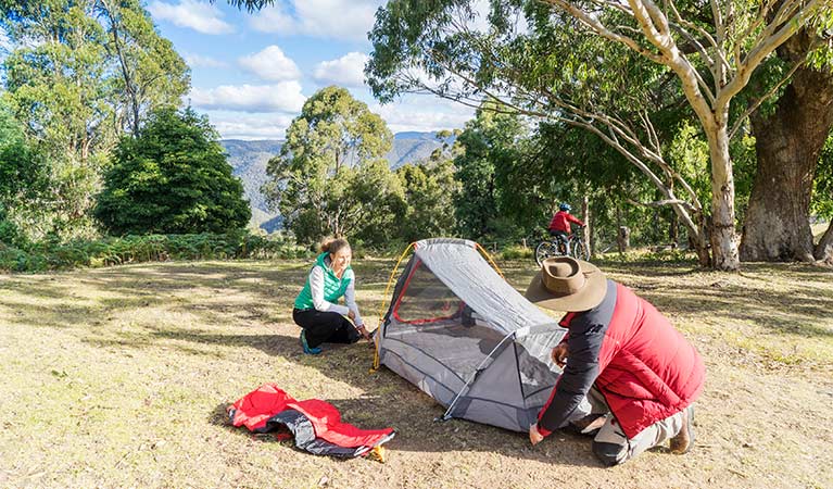
The long and adventurous drive into the Southern Blue Mountains area means it’s best experienced by camping overnight at Mount Werong campground. Yerranderie Private Town also has camping, or you can stay in one of the rustic accommodation options after a guided tour. Dunphys campground is around 45mins drive from Blackheath but feels worlds away. Walkers can take advantage of family friendly strolls like Ruby Creek walk, climb Yerranderie Peak, or tackle overnight and multi-day hikes. Fire trails wind through the park, ideal for 4WD and mountain bike adventures. They’re also easily combined with visits to neighbouring Jenolan Caves, Kanangra-Boyd National Park or Wombeyan Caves.
- 4WD Oberon Colong historic stock route Intrepid 4WD tourers will love the 4WD Oberon Colong historic route. Travel through the wild south of Blue Mountains National Park to a historic mining ghost town in Yerranderie Regional Park.
Greater Blue Mountains World Heritage Area
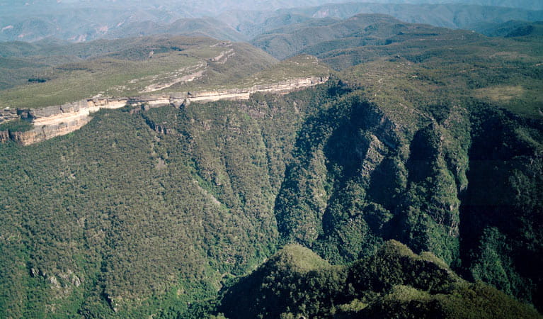
Blue Mountains National Park is 1 of 8 national parks and reserves that make up the Greater Blue Mountains World Heritage Area (GBMWHA). In 2000, UNESCO recognised the area's outstanding geology, biodiversity, and Aboriginal significance. The GBMWHA lies within the Country of the Darug, Gundungurra, Wiradjuri, Darkinjung, Wanaruah and Dharawal People. With 1 million hectares of rugged plateaux, sheer cliffs, deep gorges, it protects unique ecosystems teeming with rare plants and animals. Over 95 species of eucalypt trees have evolved here over millions of years, making it the most diverse eucalypt forest in the world. The Southern Blue Mountains area provides access to the protected Kowmung River, a declared Wild River, and the Kanangra Wilderness.
- Greater Blue Mountains 2-day wilderness safaris Venture deep into Blue Mountains wilderness on this exciting 2-day safari with Dingo Tours. Travelling well beyond the crowds, you'll explore hidden canyons and dense forests and even see native wildlife, all in stunning World Heritage surrounds.
Plants and animals protected in this park
Animals
-
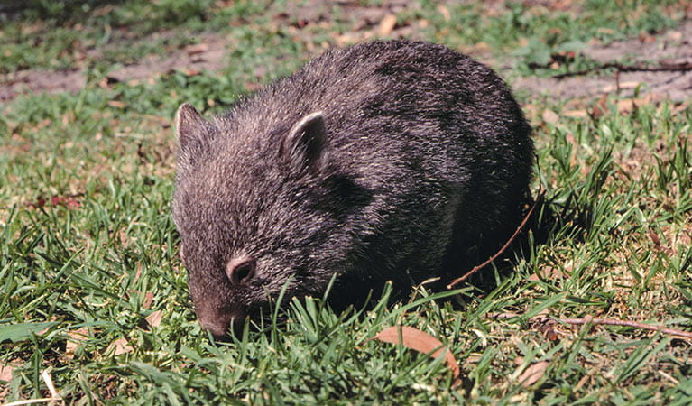
Bare-nosed wombat (Vombatus ursinus)
A large, squat marsupial, the Australian bare-nosed wombat is a burrowing mammal found in coastal forests and mountain ranges across NSW and Victoria. The only other remaining species of wombat in NSW, the endangered southern hairy-nosed wombat, was considered extinct until relatively recently.
-
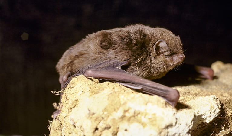
Eastern bentwing-bat (Miniopterus schreibersii oceanensis)
Eastern bentwing-bats congregate in caves across the east and north-west coasts of Australia, in colonies of up to 150,000. These small Australian animals weigh around 13-17g and can reach speeds of up to 50km per hour. Eastern bentwing-bats use both sight and echolocation to catch small insects mid-air.
-
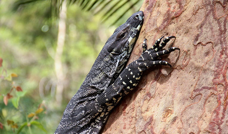
Lace monitor (Varanus varius)
One of Australia’s largest lizards, the carnivorous tree-dwelling lace monitor, or tree goanna, can grow to 2m in length and is found in forests and coastal tablelands across eastern Australia. These Australian animals are typically dark blue in colour with whitish spots or blotches.
-
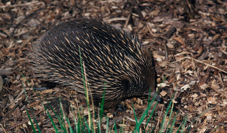
Short-beaked echidna (Tachyglossus aculeatus)
One of only 2 egg-laying mammals in the world, the short-beaked echidna is one of the most widespread of Australian native animals. Covered in spines, or quills, they’re equipped with a keen sense of smell and a tube-like snout which they use to break apart termite mounds in search of ants.
-
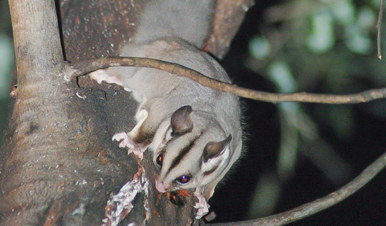
Sugar glider (Petaurus breviceps)
The sugar glider is a tree-dwelling Australian native marsupial, found in tall eucalypt forests and woodlands along eastern NSW. The nocturnal sugar glider feeds on insects and birds, and satisfies its sweet tooth with nectar and pollens.
-
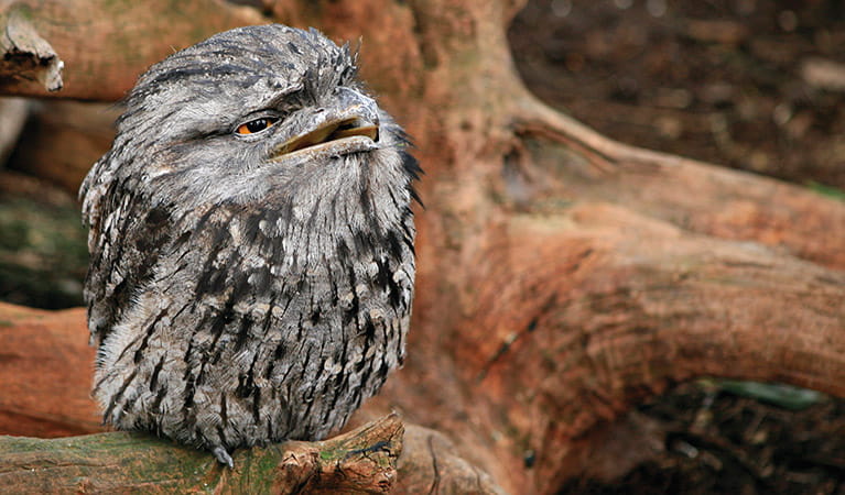
Tawny frogmouth (Podargus strigoides)
Found throughout Australia, the tawny frogmouth is often mistaken for an owl due to its wide, powerful beak, large head and nocturnal hunting habits. The ‘oom oom oom’ call of this native bird can be heard echoing throughout a range of habitats including heath, woodlands and urban areas.
-
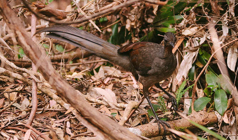
Superb lyrebird (Menura novaehollandiae)
With a complex mimicking call and an elaborate courtship dance to match, the superb lyrebird is one of the most spectacular Australian animals. A bird watching must-see, the superb lyrebird can be found in rainforests and wet woodlands across eastern NSW and Victoria.
-
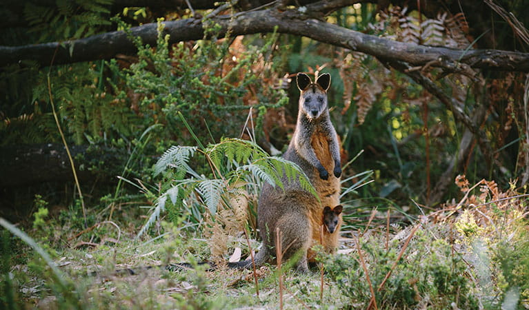
Swamp wallaby (Wallabia bicolor)
The swamp wallaby, also known as the black wallaby or black pademelon, lives in the dense understorey of rainforests, woodlands and dry sclerophyll forest along eastern Australia. This unique Australian macropod has a dark black-grey coat with a distinctive light-coloured cheek stripe.
-
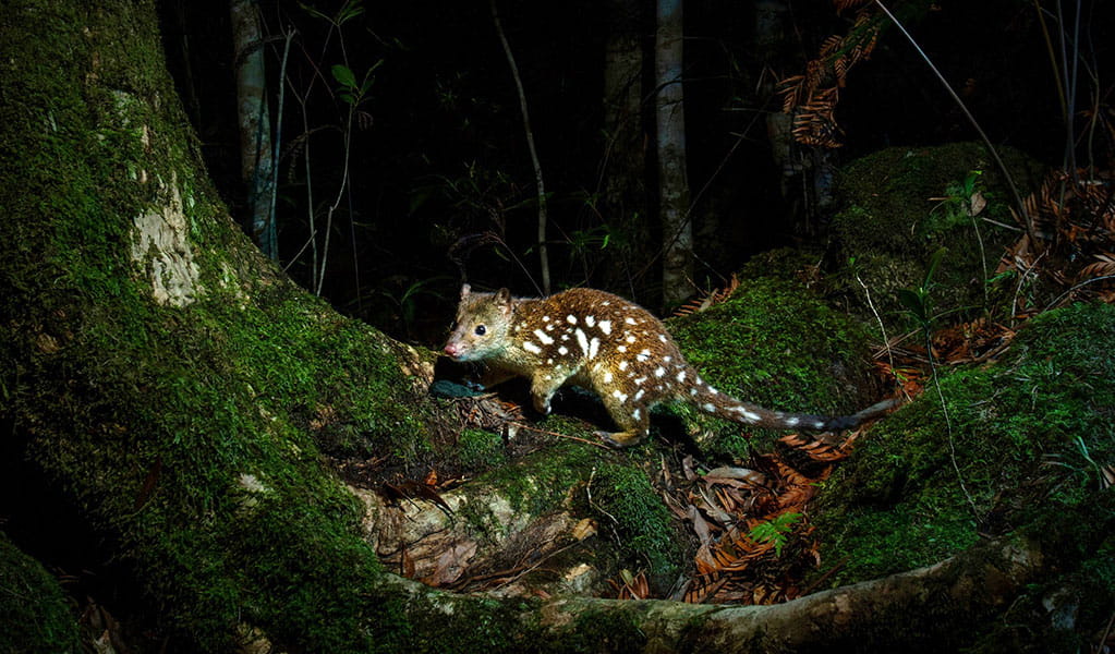
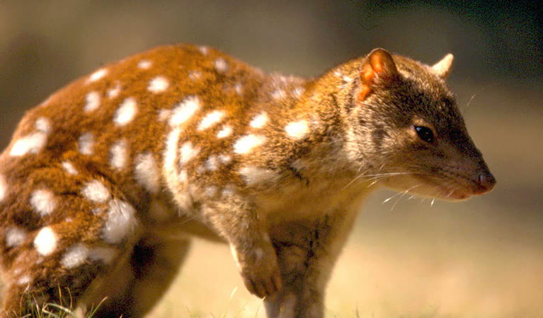
Spotted-tailed quoll (Dasyurus maculatus)
The spotted-tailed quoll is the largest remaining carnivorous marsupial on the Australian mainland. It’s protected as a vulnerable species in NSW.
Plants
-
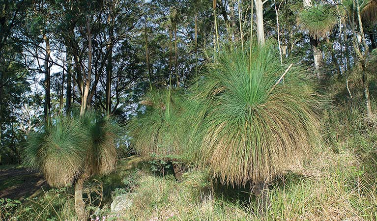
Grass tree (Xanthorrea spp.)
An iconic part of the Australian landscape, the grass tree is widespread across eastern NSW. These Australian native plants have a thick fire-blackened trunk and long spiked leaves. They are found in heath and open forests across eastern NSW. The grass tree grows 1-5m in height and produces striking white-flowered spikes which grow up to 1m long.
-
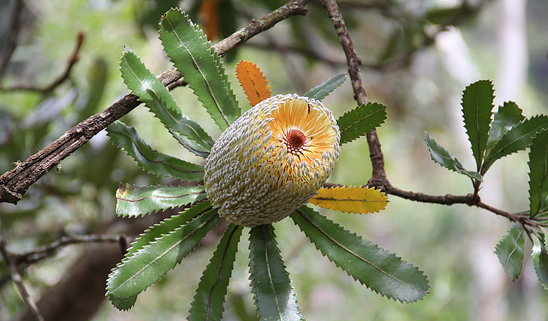
Old man banksia (Banksia serrata)
Hardy Australian native plants, old man banksias can be found along the coast, and in the dry sclerophyll forests and sandstone mountain ranges of NSW. With roughened bark and gnarled limbs, they produce a distinctive cylindrical yellow-green banksia flower which blossoms from summer to early autumn.
-
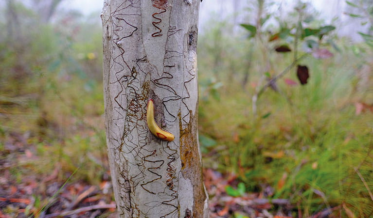
Scribbly gum (Eucalyptus haemastoma)
Easily identifiable Australian native plants, scribbly gum trees are found throughout NSW coastal plains and hills in the Sydney region. The most distinctive features of this eucalypt are the ‘scribbles’ made by moth larva as it tunnels between the layers of bark.