Gloucester River campground and picnic area
Barrington Tops National Park
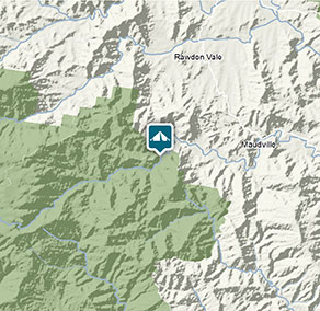
Visitor info
All the practical information you need to know about the Gloucester River campground and picnic area.
Getting there and parking
Get driving directions
From Mudgee:
- Head north on Church Street
- Continue onto Ulan Road for 9km
- Turn right onto Wollar Road and follow for 26km
- Munghorn Gap Nature Reserve occupies both sides of the road
Park entry points
- Wollar Road Northern access See on map
- Wollar Road Southern access See on map
By bike
Check out the Bicycle information for NSW website for more information.
By public transport
Munghorn Gap Nature Reserve is not accessible by public transport.
Best times to visit
There are lots of great things waiting for you in Barrington Tops National Park. Here are some of the highlights.
Autumn
Take to the park's walking tracks to make the most of cooler and drier daytime weather.
Spring
Look out for ground orchids and other wildflowers along the Polblue Swamp walking track.
Summer
Look out for the eastern water dragon basking on rocks around the streams.
Facilities
Water is not available at this campground.
Toilets
There is an accessible toilet that you can reach from the carpark via a gravel ramp.
- Non-flush toilets
Picnic tables
There are accessible picnic shelters set on concrete slabs, with a small lip from the grass onto the concrete.
Barbecue facilities
- Gas/electric barbecues (free)
- Wood barbecues (bring your own firewood)
Step-free access
There's step-free access around this campground, but there are no pathways. You'll need to cross over hard-packed ground and grass to reach the facilities.
Ramps or slopes at the campground have a maximum gradient of 1:14.
Maps and downloads
Accessibility
Disability access level - medium
- There's step-free access around the campground and picnic area, but there are no pathways. You'll need to cross over hard-packed ground and grass to reach the facilities.
- The campground and picnic area is mostly flat. Any ramps or slopes have a maximum gradient of 1:14.
- There's an accessible toilet with a gravel ramp.
- There are accessible picnic shelters set on concrete slabs.
Prohibited
Pets
Pets and domestic animals (other than certified assistance animals) are not permitted. Find out which regional parks allow dog walking and see the pets in parks policy for more information.
Smoking
NSW national parks are no smoking areas.
Park info
- in Barrington Tops National Park in the North Coast and Country NSW regions
Barrington Tops National Park is always open but may have to close at times due to poor weather or fire danger.